Skip to content

Or try searching by Category and/or Location

Interesting places

West Iceland is one big Sagaland with many resting places and services dedicated to telling the stories of the settlement of West Iceland. You can also experience a troll walk, numerus amount of jumping balloons and playing grounds that make the trip for the kids unforgettable and exciting.

It’s fun to let the kids rule the way with stopovers and stories to be found all over West Iceland.

Here are some ideas: ↓

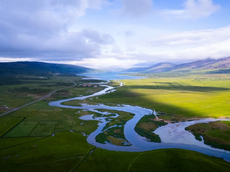
Hredavatn, lake in Borgarfjord
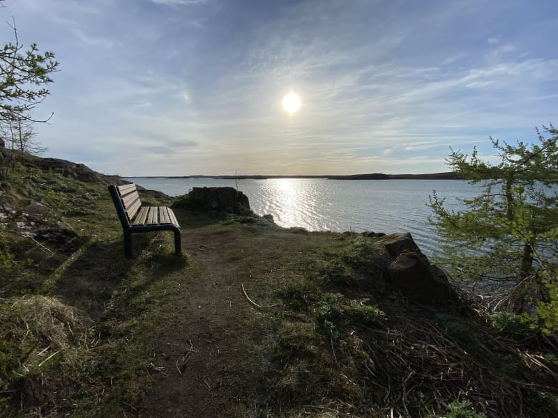
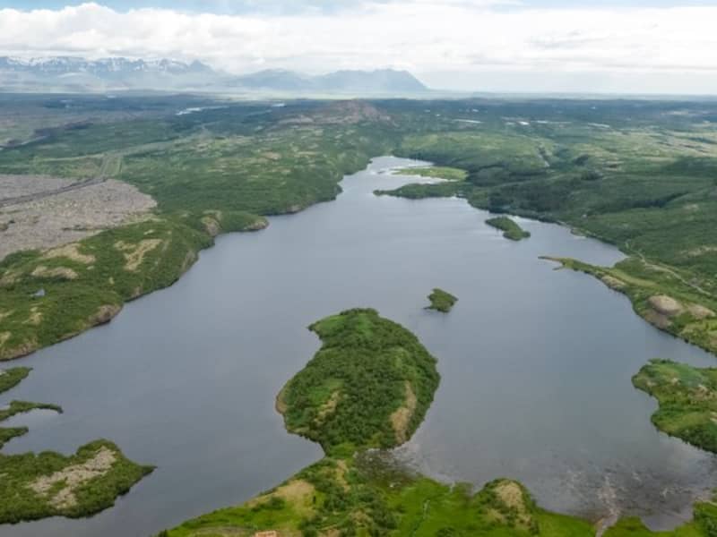
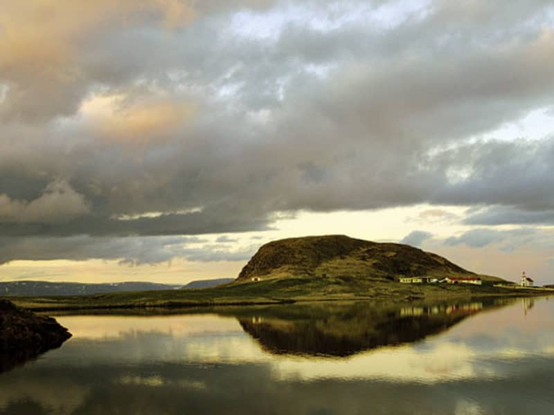
Hredavatn is a lake in West Iceland. It is located near route 1, between Borgarnes and Holtavorduheidi. Nearby is the university faculty of Bifrost and the Grábrók crater.  The lake has an area of 1,14 km
Reykholt saga circle trail
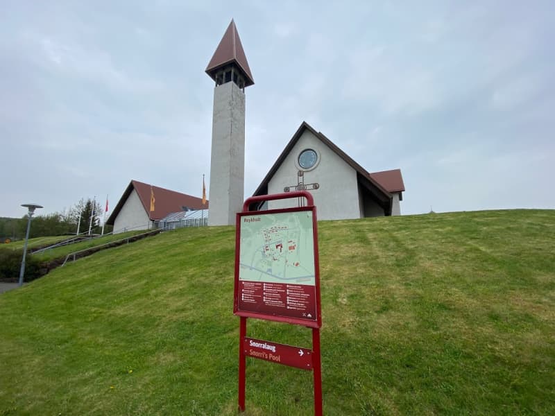
Hiking around Reykholt saga ring trail is educational and fun. An extensive work has been done on installing signs and build footpaths, making it possible to walk into Reykholtsskógur which is located above the village. It's possible to download an audioguide that adds more fun when walking around the area.  Reykholt in Borgarfjörður is a well-known village for tourists and locals. An ancient and protected pool, Snorralaug, is located in this area. According to Landnáma (the oldest book of the Settlement in Iceland), Snorralaug has been there since 960. In Reykholt is also possible to visit two churches. Reykholtsskógur "forest" is above the churches and there is an ancient highway that passes through and along the forest. Snorrastofa is a research centre where it is possible to get information about the area and where you can find guided tours, lectures and exhibitions. There is also a shop with unique products and gifts. The area has a lot to offer, specially to visitors in search of nature and/or history. Reykholt Festival is held every year at Reykholt.  Area: Reykholt, Borgarbyggð Road number to the starting point: Hálsasveitarvegur (nr. 518), Borgarbyggð Level of difficulty: Easy Length: 1.64km/1 mile Elevation: 50 meters elevation/164 ft.  Markings: No markings on the way Duration: 25 minutes Route type: Small rocks and a paved path Obstacles on the way: No obstacles Services in the area: Toilet is accessible on the route, garbage can be dumped in bins on the way and there is an option to buy guided tour of the route. Snorrastofa provides some services and there is also Fosshótel Reykholt that offers accommodation, restaurant and assistance providing information to visitors.  Illumination: Part of the route is illuminated Season: This hiking trail is open all year round GPS coordinates starting point: N64°66318 W021°292 GPS coordinates finishing point: N64°66318 W021°292 
Vedurhorfur - 112 Words for Wind
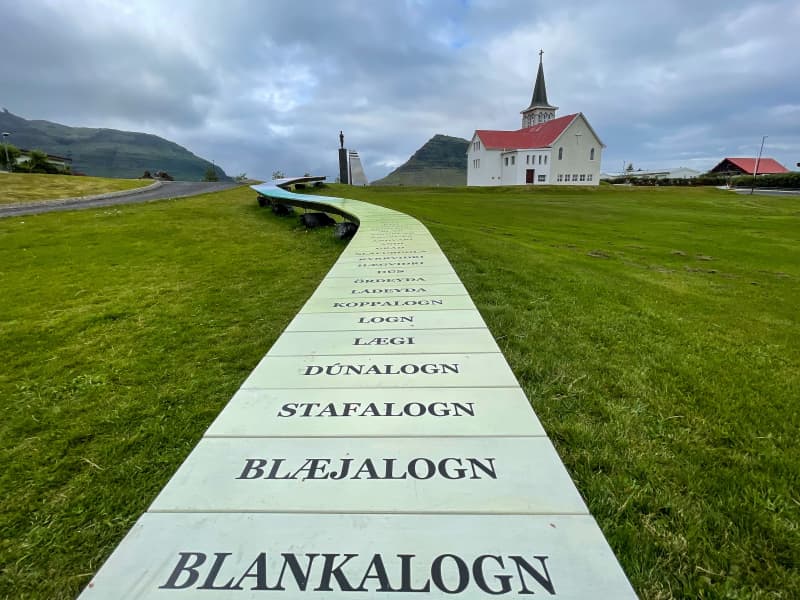
In Iceland you can find over 130 words for wind. The artist, Sólrún Halldórsdóttir, has chosen 112 words out of those 130 to include in this environmental sculpture. By choosing 112 words she is referring to the ermergency number in Iceland, 112.  Livelihood and survival of many Icelanders, especially of commercial fishermen, to this day depends on the weather, and hardly a day goes by without the weather forecast being addressed and discussed. The words are placed in escalating order, from the calmest to the strongest wind we have ever heard of. The artist uses the same color code as the Bureau of Meteorology, but shades have been added to represent each word. To decide the order of the words she interviewed elderly people around Iceland and asked about their feeling and understanding of each word.  Sólrún Halldórsdóttir (1964) was born and raised in Grundarfjörður, the second youngest of eight siblings. Her parents are Halldór Finnsson (1924) and Pálína Gísladóttir (1929). Her mother owned a bookstore in Grundarfjörður and taught Sólrún, at an early age, the love for the language.  The sculpture is 18 meters long and 60 centimeters wide, made of stone, steel and hardwood. 
Brynjudalsskógur forestry
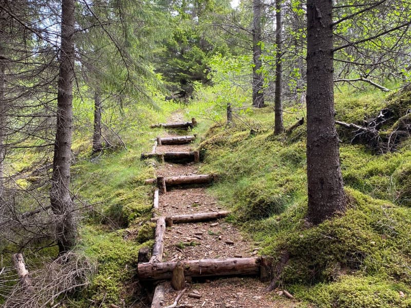
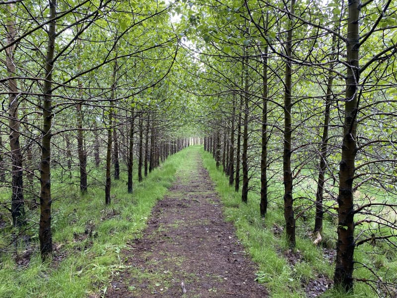
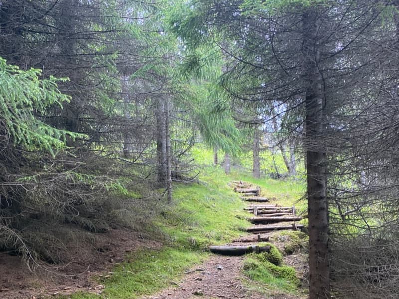
Since 1990, the Icelandic Forestry Association has engaged in Christmas tree cultivation in Brynjudalur in Hvalfjörður, an indispensable part of Christmas celebrations tradition. In Brynjudalsskógur, wood has been used for the construction of shelters and paths. There are two shelters in the forest, several resting places and a puzzle track. There are numerous walking paths in the forrest along with paths that can be used as a starting or finishing point for hiker going the traditional hike over Leggjabrjótur, over to Þingvellir or up to Botnsúlur.  Into Brynjudalur you will find great tranquility and proximity to an immensely beautiful mountain range, where Botnssúlur mountain range loom over the area. The area is busy during the Christmas season, where Christmas tree sales take place there every year. The forest itself is well-kept and is very neat. A hiking trail through Brynjudalsskógur offers guests tranquility and beautiful surroundings. The mountainous terrain around the forestry gives a great impression on the environment and the forestry is a quiet place to enjoy and experience. The area has different hiking trails as well as numerous resting stops. Hiking paths can be found in the forest and some of them are used as starting or ending routes for traditional hiking trails on Leggbrjót over to Þingvellir or up to Botnsúlum. Area: Kjósahreppur.  Road number to the starting point: Hvalfjarðarvegur (nr. 47). Drive into Ingunnarstaðaveg.  Difficulty level: Easy  Length: 3.2km/ 1.98 miles  Elevation: 103 meters/ 337.92 ft elevation.  Markings: Some parts of the hiking trail are marked.  Duration: 1 hour.  Route type: Some rocks and grass.  Obstacles on the way: Steps on the way.  Services in the area: No services in the area.  Illumination: No illumination.  Season: The hiking trail is open all year round.  GPS coordinates to the starting point: N 64°21.8068 W 021°18.1513  GPS coordinates to the finishing point: N 64°21.8068 W 021°18.1513 
Kleppjárnsreykir in Borgarfjord
Kleppjarnsreykir in Borgarfjord is a small village where many of the inhabitants are green house farmers that use a geothermal heat. Some of the product can be bought diretly from the farms.  In the village is also an elementary school and a kindergarden along with a small shop and a camping site. 
Danielslundur wood in Borgarfjordur
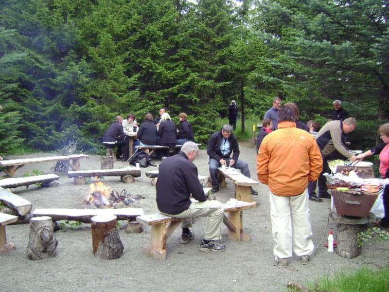
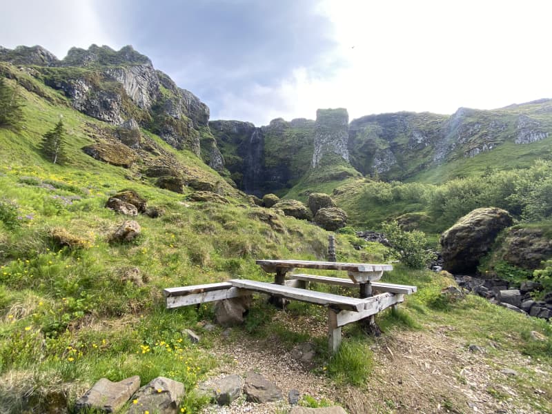
Danielslundur in Borgarfjord is a wood, open to everyone. Parkings just out of road one. Ideal to stop and enjoy nature, have picnic or just walk around on the paths. Table, benches and grill are there to use. 
Garðalundur park Akranesi
Garðarlundur country park, protected for recreational use and the preservation of the typical landscape of the area. The areas’ main characteristics are its rocky islands or bluffs that rise from the areas’ vast flat wetlands.
Varmaland hiking trail
Varmaland is a small village that has been built around geothermal area in Stafholtstungur in Borgarbyggð. The settlement is located in between Hvítá river and Norðurá river, with a kindergarten, swimming pool and a gymnasium. Laugaland, which is a small farm in the area that uses the geothermal energy for gardening, but cucumbers are grown there all year round. Hotel Varmaland is located in the heart of the village and Varmaland is a popular place to visit and to stay.   Varmaland in Borgarbyggð is a well-known place for tourist, both domestic and international. Varmaland´s campsite has been known among domestic tourists for years, but with the arrival of Hotel Varmaland, more foreign tourists have been introduced to the area. Varmaland is clearly visable from highway no. 1, but the lights and the steam coming fromthe area is very visable. The trail through Varmaland is located in forestry, on the cliffs above Varmaland but from there, you will find great views over the surrounding areas. The trail starts at Hotel Varmaland but turns into theforestry, where you can find a playground for younger generation but also numerous walking and hiking paths. A variety of paths, together with a beautiful landscapes, makes a walk through Varmaland, a very interesting and fascinating experience.   Area: Varmaland, Borgarbyggð.  Road number to the starting point: Hotel Varmaland (no. 527 Varmalandsvegur).  Level of difficulty: Easy.  Length: 5.03km  Elevation: 75 meters.  Markings: Markings can be found.  Duration: 1.07 hours.  Route type: Mixed, small rocks, grass.  Obstacles on the way: Steps on the way.  Services on the way: Hotel Varmaland and gymnasium/swimming pool at Varmaland.  Illumination: No illumination.  Season: The trail is open all year round.  GPS coordinates starting point: N64°21.2886 W021°36.6383  GPS coordinates finishing point: N64°21.2886 W021°36.6383 
Eiriksstadir
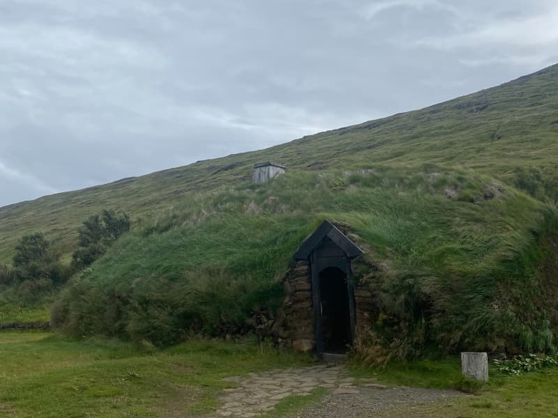
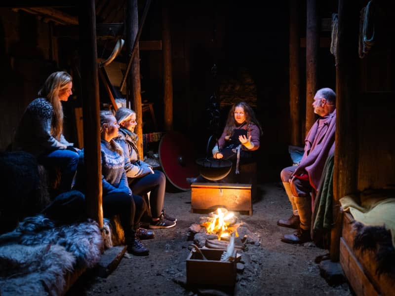
Eiríksstaðir is one of most historic sides of Iceland. Step back to the Viking Era and immerse yourself in the sights, sounds and scents of Eriks the Red's farm which is also the birthplace of Leif the Lucky who is said to have discovered America. Modern day vikings demonstrate the lifestyle of 1000 years ago, sharing their crafts and knowledge.
Hvanneyri walking trail
Hvanneyri is a small, growing urban area in Borgarfjörður, where the headquarters of the Agricultural University of Iceland (LBHÍ) is located, but also where the Agricultural Museum of Iceland is located, the store Ullarsel and Hvanneyratorfan, which are the old schoolhouses in Hvanneyri. The trail goes out to Andakílsá, a protected area of the Environment Agency, a Ramsar site, that is a bird sanctuary around Hvanneyri. Hvanneyrartorfan is a protected area of the Heritage Foundation, but in addition, the Agricultural University of Iceland has taken care of the maintenance of footpaths in the area as well as volunteers. There has been a lot of development in hiking trails and outdoor recreation areas in Hvanneyri and has a wide attraction for outdoor enthusiasts.   Hvanneyri has history, nature and outdoor activities to offer. The bird life in the area is varied, but the attraction ofwildlife has drawn many tourists to see the whitefronted goose, whose protected area is in Hvanneyri. Torfan attracts visitors to Hvanneyri, but the old school buildings are still in use and have different functions, such as a cafe, sportshall, museum building and apartments for the teachers of the University of Agriculture.   Hvanneyrartorfan is on the Icelandic Heritage Foundation's list of protected buildings and structures, but they areHvanneyrarkirkja (built in 1905), School House (built in 1910), School Principal's House (built in 1920), Skemman (built in 1896), Gymnasium (built in 1911), Hjartarfjós ( built between 1900-1901), Halldórsfjós and barn (builtbetween 1928-1929) and Vélahús. The Environment Agency protected Hvanneyri as a habitat for birdlife in 2002, but then expanded the area in 2011 and was then named Andakíll. The goal of conservation was and is to protect the wetlands found there, which are the habitat of numerous bird species.  The trail starts at the parking lot of the Icelandic Museum of Agriculture and goes towards LBHÍ, heading out to Andakílsá. The trail joins the main road in a small section, but otherwise you walk on dirt roads, mats, paved paths, tree trunks and some rocks.  From April 20 to July 20 is the nesting season for birds, so visitors to the area are advised to pay special attention to birdlife in the protected area. Dogs/cats are not allowed to roam freely in the area.   Area: Hvanneyri, Borgarbyggð.   Road number to the starting point: Agricultural Museum of Iceland (Hvanneyrabraut no.53).  Level of difficulty: Easy path.  Length: 8.77km  Elevation: 12 meters.   Markings: Path is marked but not everywhere.   Duration: 1.46 hour.   Route type: Small rocks, mixed materials and tree curls.  Obstacles on the way: Steps are on the paths.  Services on the way: At the Agricultural Museum, at the Ullarsell store and at the LBHÍ.  Illumination: No illumination.   Season: The trail is open all year round but it is important to stay on the trail from 20th of April to 20th of July each year because of the nesting season in the area. GPS coordinates starting point: N64°33.8794 W 021°45.9281  GPS coordinates finishing point: N64°33.8794 W 021°45.9281 
Snæfellsjökull National Park
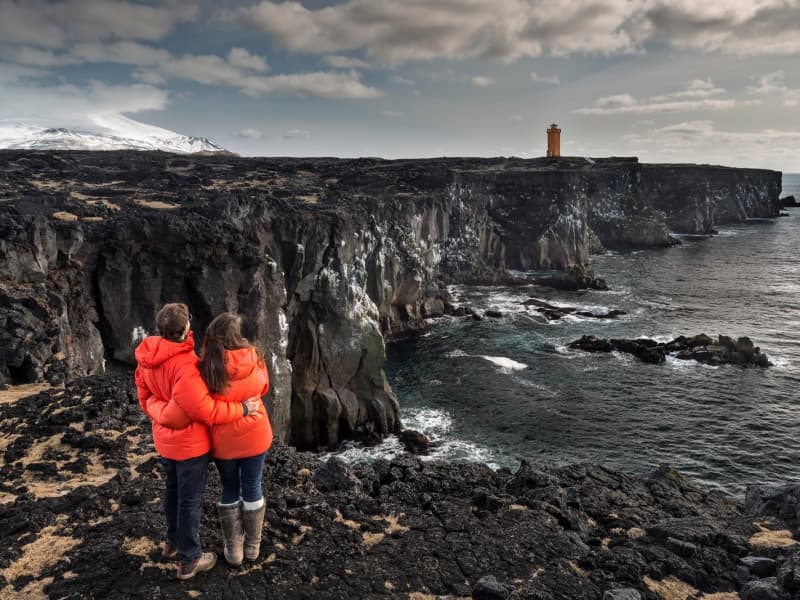
Snæfellsjökull National Park is located at the edge of Snæfellsnes in the West part of the country. It is about 18km2 and the first national park to stretch from the top of the mountain and all the way down to the ocean. The Park is open all year long. There is a Visitor center at Malarrif and National Park Center at Hellissandur . See a map of the area in 3-D. Snaefellsjokull National Park 
Arnarstapi
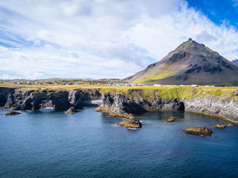
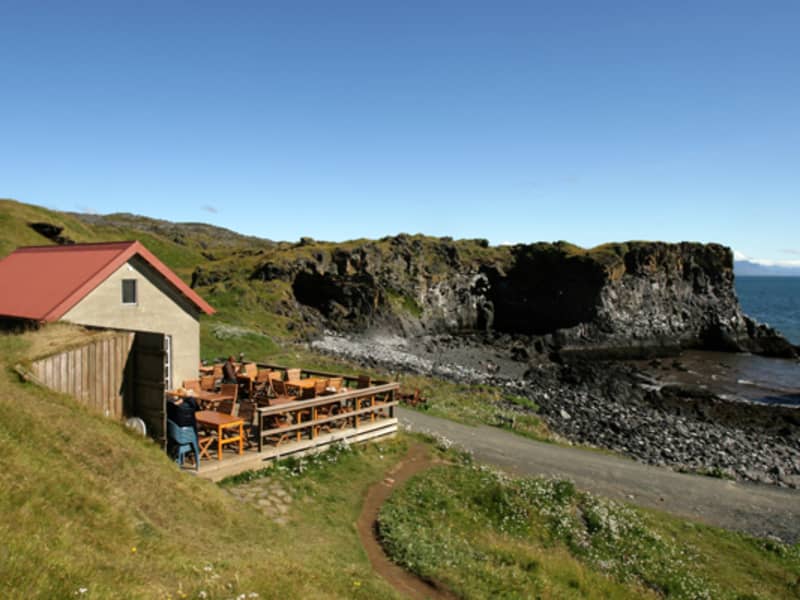
Arnarstapi was an important trading post in the past and had a much bigger population than it has now. Columnar basalt, ravines and grottoes surround the Arnarstapi pier. There is good anchorage for small boats. There is quite a large arctic tern colony in the village itself. A walk along the coastline is recommended to watch the birds and the magnificent lava formations. The seaside and the cliffs between Arnarstapi and Hellnar have been made a Natural Reserve in 1979. A very interesting old path follows the coastline where you can see old lending places of fishermen, lots of birds like the kittiwake, the Arctic tern and the fulmar and pass through a lavafield. If you take a guided tour, you will also hear a ghost story. A sculpture of Bardur Snaefellsas by Ragnar Kjartansson stands by the beach at Arnarstapi.
Ytri Tunga walking trail
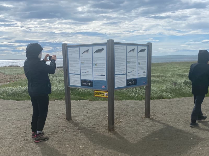
Ytri-Tunga beach is first and foremost one of the best seal-watching spots in Iceland. Seals come here to hang around thanks to rocky shore where they can find a perfect combination of mainland and the close proximity of the safe ocean. A lot of work has been put in for brand new walking trails, from the car park to the shore.  Please bear in mind the following:  Please keep a minimum distance of 50 metres to the nearest seal. If pups are observed, a 100 m distance to the nearest seal is recommended.  If a seal makes a sound, moves or seems alert, it might be a sign of disturbance. In that case, move further away.  Females often leave their pups temporarily to go hunting. Plese do not attempt to access or touch the pups that appear to have been abandoned. Leave the pups alone so the mother can return to her offspring naturally.  Never position yourself between a seal and the ocean. It is important that the seal has easy access to the water to feel safe and secure. When walking towards the seals, do so with slow and calm moves. Avoid loud noises and, if talking, keep your voice down. Leave the area in the same quiet manner. Do not throw objects in the area close to the seals. Avoid using camera flash when photographing. Seal welfare may be negatively impacted by large groups of people in the seal habitat. On arrival, if you encounter a large group of people already close the the seals, please wait until some of the people leave.  Dogs are to be kept on leash at all times.  ------------------------------------------------------------------------------------------------------------------------------------------------- Area: Ytri-Tunga, Snæfellsnes Road number to the starting point: Car parking at Ytri-Tunga, Snæfellsnesvegur (no. 54) Level of difficulty: Easy/Moderate Length: 1.67 km. Elevation: 7 m. Markings: Markings are on the route Duration: 27 min. Route type: Small rocks, mixed materials and grass Obstacles on the way: There are steps on the trail Service in the area: No service Illumination: No illumination on the route Season: The route is open all year round GPS coordinates to the starting- and the finishing point: N 64°48.2310 W 023°04.8595
Bjossarolo - playground
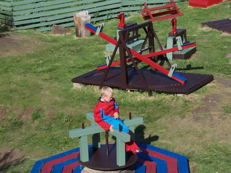
Bjossarolo is a playground for children in Borgarnes, not far from Edduveröld or the Settlement Centre. It was constructed by Bjorn Gudmundsson, a man who was ahead of his time and thought about recycling. He used exclusively things that had been thrown away to build up this special place. At the playground there are for example swings, slides, an old boat, a castle and a lot more in a hollow enclosed by rocks not far from the sea. And on going there you could look for shells or nice stones on the beach. The small, but very pretty park Skallagrimsgardur is not far away. There you can even find the grave of a saga hero!
Skallagrímsgarður, public park in Borgarnes
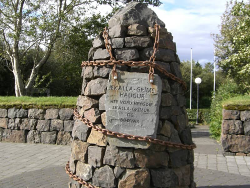
In the heart of Borgarnes is Skallagrímsgarður, a small public park which is ideal for a picnic. The park plays an important role in Egil's Saga, as the burial mound of Skallagrímur Kveldúlfsson, Egil's father, is situated there. It is a good idea to relax in Skallagrímsgarður after a visit to Borgarnes swimming pool which is next to the park.
Langisandur, sandy beach in Akranes
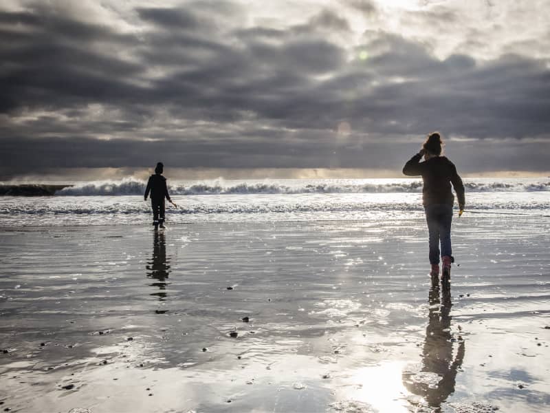
The coastline around Akranes is rich with bird life and there are many different types of beaches along the coast. One of these is Langisandur, a sandy beach and one of the most popular outdoor areas of Akranes. Langisandur is one of three Blue Flag beaches in Iceland. Guests are welcome to join the local Sea Swimming Club at Langisandur Beach three times a week. More information at the Akranes Tourist Information Office, e-mail info@akranes.is, tel: +354 894 2500.
Fossatún hiking trail
Fossatún is a well-known destination in Borgarfjörður, where you can find hiking trails related to folklore heritageand troll books, written by the local keeper, where the stories are set in west Iceland. Fossatún is located in between large summer house areas, where Skorradalur and Húsafell lie on either side of Fossatún. Grímsá river runs nextto Fossatún and you can also find spectacular views of the mountain range of Borgarfjörður at Fossatún.   Fossatún is located about 90 km from Reykjavík, on road no.50, halfway between Borgarnes and Reykholt in Borgarfjörður. Different accommodation facilities are available at Fossatún, from campsites, cottages, guesthouses and country hotel. There is a restaurant as well as facilities for guests to cook, and everyone has access to hot tubs. Fossatún is located on the banks of Grímsá river and has hiking trails along the riverside area, but there is also a hiking trail to Blundsvatn lake, where you can find diverse bird life and a beautiful view of Borgarfjörður´s mountain range.  You can walk from the service area at Fossatún and walk along Grímsá river, where you can find information signs, including sign about the saga´s, legends and trolls. The trail is very visable and accessible for a wide range of guests. The trail to Blundsvatn lake is quite visable but the accessibility is not for as wide range of guests. Grass paths with someparts on gravel is located on the trails but the trail connects the Blundsvatn lake to the Fossatún area.   Area: Fossatún, Borgarbyggð.  Road number to the starting point: Borgarfjarðarbraut (nr. 50).  Level of difficulty: Easy.  Length: 1.75km trail at Fossatún and 3.13km at Blundsvatn lake. Together: 4.8 km  Elevation: 47 meters at Blundsvatn lake and 60 meters at Fossatún. .  Markings: Markings are visable, with information signs and rock formations plentiful.  Duration: At Fossatún is 32 minuets and Blundsvatn lake 40 minuets. Together: 1.2 hours.  Route type: Small rocks and mixed materials.   Obstacles on the way: No obstacles on theroute.   Service in the area: The main service/information house at Fossatún.  Illumination: No illumination.  Season: The route is open except when temporary closed due to bad weather over the winter time or due to bird nestingtime.  GPS coordinates to the staring-andfinishing point: N64°35.5672 W021°34.6263   
Skorradalur Valley in Borgarfjord
Skorradalur is the southernmost valley in Borgarfjörður. The Skorradalur lake fills up most of the valley but the lowlands in the west are wide moorlands. There is very little traditional farming practiced today but summerhouses are becoming increasingly common and forests are growing from year to year. The Hvanneyri parish is situated at Fitjar which is deep in the valley. Forestry at Stálpastaðir is in the northern part of the valley where there are beutiful hiking trails. The camping site at Selsskógur is surrounded by lush vegetation, creating good shelter on the banks of the Skorradalur lake. 
Botnsdalur
Botnsdalur is a picturesque valley in Hvalfjörður, known for its dramatic mountains, lush landscapes, and outdoor attractions. It is the starting point for the hike to Glymur Waterfall, Iceland’s second-tallest waterfall, and home to the serene glacial lake Hvalvatn. The valley offers excellent hiking opportunities, including trails to the iconic Botnssúlur peaks. Steeped in history, the area features Icelandic sagas and played a role during WWII as a naval base. Botnsdalur is a peaceful retreat for nature lovers and adventurers alike.
Búðir
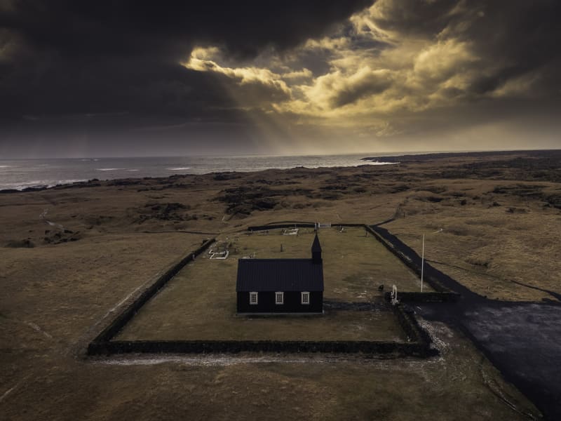
Budir is a popular destination. The landscape consists of golden sand beaches, rugged lava field and great vegetation and bird life. Budahraun lava is a nature reserve. The little black church, Budakirkja, is located at Budir. People come from all around the world to seal their love at the church. Visitors also have an impressive view of the breathtaking Snaefellsjokull glacier from Budir.
Garðalundur Akranes forestry
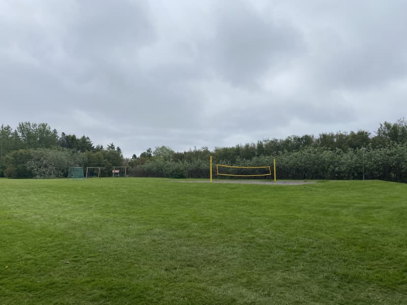
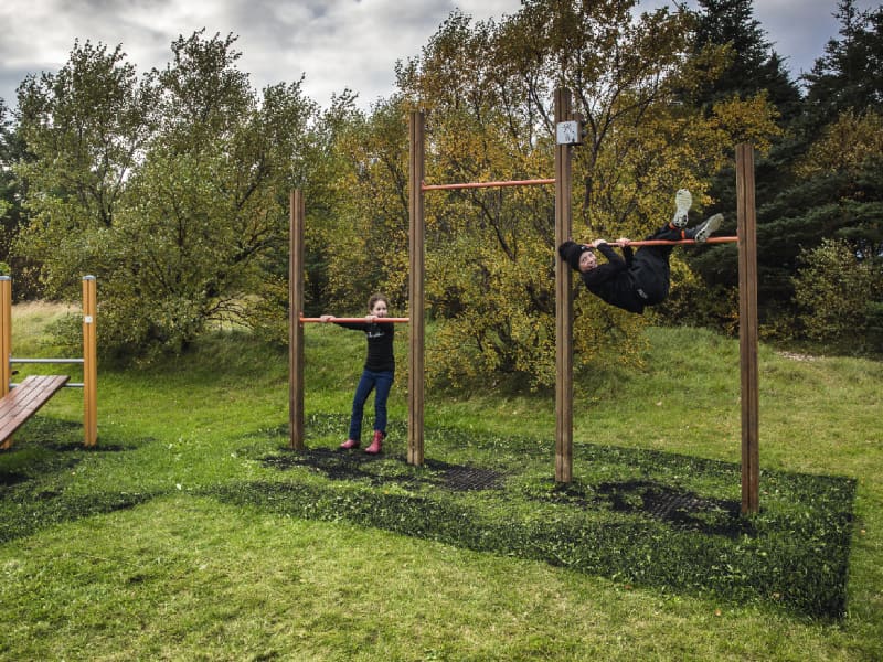
At Akranes, you can find three fun hiking trails through forestries. One is in Garðalund, one in Klapparholt and one inSlaga. Garðalundur has a variety of recreational opportunities for the residents and visitors of Akranes, Klapparholt is a forest where you can find many different types of vegetation, such as birch and pine and at Slagi forest,which is located at the roots of Akrafjall mountain, where visitors can find different walking trails, along with different plant life and fantastic views over Akranes and Faxaflói bay.   In Garðalund you can find a variety of recreation for residents and visitors of Akranes. Volleyball court, frisbeegolf course, exercise equipment, resting places, cabin, walking trails and information boards. A flourishing social area, with infrastructure like toilets and garbage bins, where visitors can enjoy the many recreational options thatcan be found in Garðalundur.  Entering Klapparholt, you can find several information sign about the area and the couple Guðmundur Guðjónsson andRagnhildur Árnadóttir, who started cultivation and organization in the area in 1988. You can also find „Klapparholtið“, but it is in the middle of the forestry. There are stories that an elf church and hidden people live in the „Klapparholtchurch“ that stands there. It is popular for outdoor enthusiasts to use the area for walking, running or cycling.  In Slaga forestry you can find resting places and infrastructure like toilets and garbage bins, but is addition there is agreat view of Akranes and the surrounding area. There is a trail from Slaga to the starting path up Akrafjall, but it is also popular for outdoor enthusiasts to use the area for walking, running or cycling.   Area: Akranes  Road number to the starting point: At Garðalund (Klapparholtsvegur) inside Akranes.  Difficulty level: Easy. Accessibility for wheelchairs and wagons but on some trails, the accessibility is not available.  Length: 12.31 km  Elevation: 50-100 meters.  Markings: There can be found marking in some of the areas but not in-between the areas. The paths are very visible.  Duration: 2.23 hours.  Route type: Small rocks, grass and mixed material.  Obstacles on the way: No obstacles inside Garðalundur and Klapparholt but there are steps and difficult grass paths in Slaga.  Services in the area: At Garðalund and at Slaga.  Illumination: Some illumination between the forestries.  Season: The walking trail is open all year round.  GPS coordinates to the starting point: N64°19.3052 W022°02.2243. At Garðalund.  GPS coordinates to the finishing point: N64°19.9648 W021°58.8807. At Slaga.  
Flatey Island Breiðafirðir
Beautifully kept old houses in cheerful colours line the dusty path through the settlement of Flatey island. Walk through it, and at the end of the settlement, the path becomes even narrower and more crooked, taking you through a dense population of birds, consisting mainly of Arctic terns. Two families stay on the island throughout the winter, but many more migrate during the summer, mainly for leisure but also to serve tourists. In a charming way, it feels very much like a movie set. And so it is. Many movies are set on the island, most notably The Honour of the House based on a short story by Nobel Prize winner Halldór Laxness, and White Night Wedding, a movie by Baltasar Kormákur. In fact, Baltasar’s father painted the unusual altar piece in the island’s church, making it worthy of a visit. In summertime, a ferry goes to Flatey twice a day from Stykkishólmur and Brjánslækur, and, albeit less frequently, a passenger boat offers connection to Reykhólar.
Borgarnes swimming pool
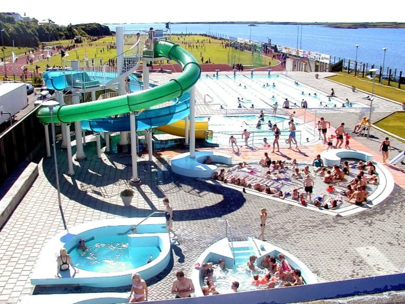
In the sports stadium, you will find both an outside and an inside swimming pool, hot tubs, a steam bath which is fed with steam straight from the Deildartunguhver hot spring, a children’s pool and water slides. All in all, an excellent health spa.
Staupasteinn in Hvalfjörð
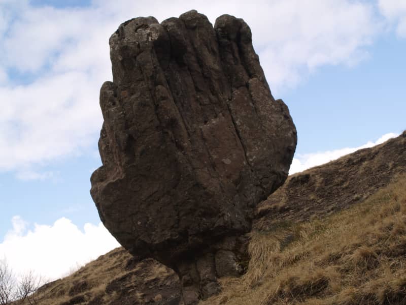
A goblet-shaped rock and popular resting place for tourists. Close to Hvammsvik on the old national road around Whale Fjord. An elf by the name of Staupa-Steinn has his home in this rock. Not everyone can see him. He is described as having long hair, a beard and being a kind, gentle man who loves to play ball with children who are picnicking in the area. Beautiful view. Protected since 1974.
Laugar in Sælingsdal in Dalir
Gudrun Osvifursdottir, heroine of Laxdaela Saga, was born (973AD) and brought up at Laugar. It is said that she used the hot water pool there a lot and also met there her followers Kjartan and Bolli. There is a geothermal area at Laugar and a naturally-heated swimming pool was built there in 1932. The hot water is also used for heating up the buildings at the place. Now there is a 25 meter outdoor swimming pool, with hot tubs, sauna and more.  At about 3 km from Laugar you may find the rocky hill Tungustapi, home of elves.
Eldborg Crater hiking trail
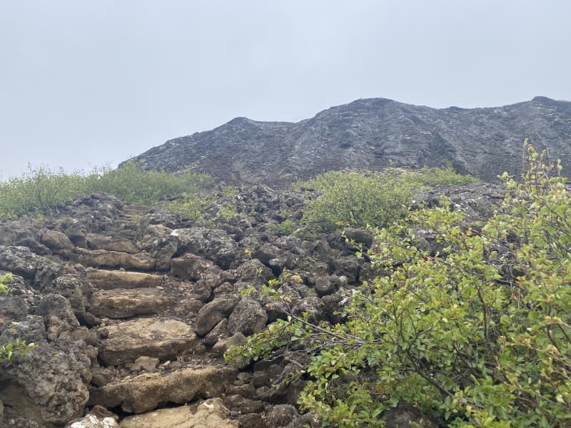
Eldborg is a typical crater that rises 60 meters above the surrounding lava and is the largest crater within short fissure. The crater is oval, above 100 meters in diameter and 50 meters deep. The walls are steep and made of ultra-thin layer of lava. Eldborg was declared protected natural monument in 1974. The trail up to the crater is diverse. Beautiful lava formations can be found on the way while walking. From the Crater's top it is possible to contemplate magnificent views in all directions, and specially if there is good weather conditions and good visibility, it is even possible to observe the fjords from the Snæfellsjökull Glacier, all the way to Reykjanes.  The trail begins in Snorrastaðir's service area, where you can find accommodation along with facilities for groups, all sizes and types. The trail is composed with different surfaces but the majority of the trail is on lava substrate.  When going up the Eldborg's hillside, it is possible to use chains that are available there to assist hikers going up or down. Area: Hnappadalur, Borgarbyggð Road number to the starting point: Snæfellsnesvegur (nr. 54), Snorrastaðir Level of difficulty: Easy, however it should be noted that there are lot of high steps on the way Length: 6.64km / 4.12 miles Elevation: 50-100 meters / 164-328 ft.  Markings: Little markings on the way Duration: Approx. 1 hour and 27 minutes  Route type: Small and large rocks, lava and mulch substrates  Obstacles on the way: There are a lot of steps to find on the way / it can be difficult to find the way Services in the area: A toilet is available on the way and trash can be deposited in Snorrastaðir service area Illumination: Part of the route is illuminated, from Snorrastaðir until the beginning of the trail Season: The hiking trail is open all year round GPS coordinates starting- and finishing point: N64°46.4456 W022°18.1262
Eiriksstadir walking route
At Eiríksstaðir in Dalir there are ancient ruins which are probably the farm of Eirík the Red Þorvaldsson and his wife Þjóðhildur Jörundardóttir. The ruins of the farm are protected ancient monuments.  A little west of the ruins at Eiríksstaðir, a replica farmhouse was built, which was inaugurated in 2000 on the occasion of the 1000th anniversary of Leif's successful landing in America.  At Eiríksstaðir there is a living museum. The staff is dressed according to the traditions of the 10th century and educate visitors about life a thousand years ago, old work culture and farming practices. You can also view crafts, weapons and various items from the period. There are also historical information signs in the area and a statue of Leif Eiríksson by Nína Sæmundsson.  Road no. 60 (Vestfjarðarvegur). Turn right onto road no. 586 (Haukadalsvegur) and drive to the parking lot at Eiríksstaðir. There is a good parking lot and a service cabin, along with toilets and information boards. Trails lead to the replica turf house but also to monuments in the area. The trail is partly with small gravel and partly with pavement rocks.  Area: Dalabyggð Road number to the starting point: Road number. 586 (Haukadalsvegur) Level of difficulty: Easy/moderate Length: 0.6 km. Elevation: 29 m. Markings: No markings but the route is visible, except in the case of heavy snow Duration: 13 minutes Route type: Small-paved and flat rocks Obstacles on the way: No obstacles Service: Toilets, garbage bins and the possibility to buy a guided tour in the replica house during opening hours Illumination: No illumination Season: Hiking trail is open all year round, but can be unpassable during heavy snow GPS coordinates to starting- and finishing point: N 65°03.5023 W 021°32.1731
Ólafsvík walking trail
A hiking trail around Ólafsvík borders and into the town's heart is enjoyable and diverse. Service area is located at the campsite and a lot of resting places along the trail. Information signs are plentyful on the trail along side playground equipment for all ages. The trail is suitable for everyone who wants to enjoy.  There is a campsite located on the eastern borders of Ólafsvík and it takes about 10 minutes (walking) into the center of Ólafsvík. There you will find facilities for guests like toilets, showers, electricity, cooking facilities and waste disposal. An equipped playground is also located in the area. Guests who walk through the many hiking trails available, will have the chance to be in contact with nature, appreciate beautiful vegetation and nature. Resting stops area also available on the way. Ólafsvík hiking trail is varied and fun.  The Ólafsvík Forestry Association has put up all the efforts on connecting the forestry with the town, but also with building up a hiking trail going up the mountain Enni and the mountainous area above Ólafsvík. There's plenty of information on the hiking trail, views of Ólafsvík and forestry. The area is ideal for outdoor activities, and there are numerous activities along the way such as Frisbee golf courses, hop balloons and more.  Area: Ólafsvík Road number to the starting point: Útnesvegur (nr. 574) at the Ólafsvík campsite Level of difficulty: Easy Length: 4.26km/2.64 miles Elevation: 50 meters/164 feet Markings: Stakes Duration: 1 hour Route type: small rocks, woodchips Obstacles on the way: Steps on the way Services in the area: Campsite service center Illumination: No illumination Season: This trail is open all year round GPS coordinates starting point: N64°53.3401 W023°41.2849 GPS coordinates finishing point: N64°53.3401 W023°41.2849
Helgafell Holy Mountain
Holy Mountain, 73 m with a breathtaking panoramic view across Breiðafjordur Bay. A viewing dial is at the top.   Folklore advises anyone climbing the mountain for the first time to walk straight up without looking back or speaking and three wishes will be granted. The wishes have to be of good intent and the wisher tells no one and faces east when making them.  A small remnant of a wall on the mountain top is dated 1184 and was a part of a nearby monastery built at this time. 
Álfholtsskógur foresty
An outdoor area into Álfholtsskógur forest is a popular destination for travelers in Hvalfjarðarsveit but the accessibility has been improved over the las few years and is defined as an "Open forrest". There are markings along the trails and resting stops. The beginnings of forestry in Álfholtsskógur can be traced back to 1939, and today more than 130 species of trees and flora can be found in the forest. Hiking trails around Álfholtsskógur are diverse and challenging, but the facilities to enjoy are first class. Resting stops to eat a picnic or only simply enjoy the area, are available and there are markings on the trails. Members of the Skilmannahreppur Forestry Association have worked on marking the routes and improving access for hikers, with the construction of bridges and different steps up the slopes of Álfholtsskógur.  Area: Hvalfjörður.  Road number to the starting point: Akrafjallsvegur (nr. 51).   Level of difficulty: Easy.  Length: 7 km/ 4,34 miles.  Elevation: 0-50 meters /164 ft elevation.  Markings: The route is marked with signs pointing out the way.  Duration: 1 hour and 30 minutes.  Route type: Small rocks, wood chips, grass and mixed substrate.  Obstacles on the way: Steps and bridges on the way.  Services in the area: There are trash bins in the parking area.  Illumination: No illumination.  Season: This hiking trail is open all year round.   GPS coordinates to the starting point: N 64°22.2406 W 021°51.0028.  GPS coordinates to the finishing point: N 64°22.2406 W 021°51.0028. 
Hellnar in Snæfellsnes
For centuries, Hellnar was among the largest fishing villages beneath the Snaefellsjokull ice cap. Valasnos, a freestanding rock, extends east of the bay. One of Iceland's most peculiar caves, Badstofa, is there. It is known for its special light exposure and colourful interior. A cold water spring is to be found at the lava's edge. It is dedicated to the Holy Virgin because it is said she appeared there once. The Hellnar church was built in 1945 on a picturesque site where a church was first raised in 1833. Located at Hellnar is a Hotel and a charming little café.
Borgarnes walking trail
While visitors are welcomed by the majestic and 4 million years old Hafnarfjall mountain, at the same time they can admire the imponent Snæfellsjökull glacier in the distance. Hvítá river runs along Borgarnes coastline and across Borgarvogur bay, you can have an overlook of the historic, Borg á Mýrum.  Borgarnes is the l argest urban centre in Borgarfjörður, with around 3.800 inhabitants. The town is a well-known resting place for domestic and foreign tourists, but even if you are travelling around the country and passing through Borgarnes, it is worht a visit, as there are many services available, whether it is in the form of accommodation, refreshments or activities and also many resting stops with beautiful views, information signs on the history of Borgarnes and about the ecosystem of Borgarvogur.  Borgarnes is on the beaten track, either if you are driving in the direction to Snæfellsnes or driving south to Reykjavík or north to Akureyri. Numerous hiking trails can be encountered in Borgarnes. From new walking paths, with access for carriages and wheelchairs, to hidden paths that are hidden in many places in between the residential areas of Borgarnes, all with different substrates, design and accessibility.  The hiking trail is connected to the campsite, sports ground and service area but it should be noted that it is needed to walk across highway no. 1 and there is no underpass or brigde. Skallagrímsgarður, Vigdísarlaut, Granastaðir, Vesturnes, Suðurnes, Miðnes, Bjössaróló , Hlíðartúnshús and Hjálmaklettur are some examples of fun areas connected to the hiking trail around Borgarnes.  Area: Borgarnes, Borgarbyggð  Address of the starting point: Brákarbraut 15, Borgarnes Level of difficulty: Easy. Length: 9.89km/6.14 miles. Elevation: 50-100 meters/164-328 ft.  Markings: No markings. Duration: 2 hours. Route type: Mud and small rocks substrates. Obstacles on the way: Several small steps are on some paths.  Services in the area: Services around the area and in the camping site in Granastaðir, Borgarbyggð information center. Illumination: Part of the route is illuminated. Season: The hiking trail is open all year round.  GPS coordinates starting point: N64°53523 W021°923 GPS coordinates finishing point: N64°53523 W021°923
Húsafell hiking trails
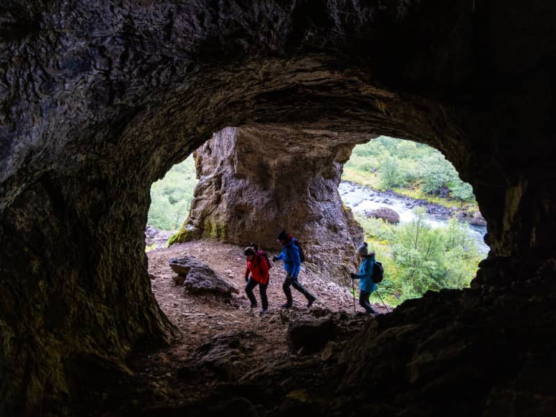
Húsafell offers diverse and fascinating hiking trails where dense forests, spectacular ravines, waterfalls, glaciers, fauna and bird life as well as cultural markings making the area so attractive. A map with different hiking trails accessible in the area is available at Hotel Húsafell's building and website.   Húsafell is one of the most popular holday places in Iceland, but recently became defined as a residential area too. There are numerous activities around the area that will suit everyone's preferences whether it is hikings, glacier tours or cave exploring, golf. dip in geothermal water and even wild life /animal life observation (different bird and foxes). The beginning of hiking trail is at Hotel Húsafell and there is a large information sign below the hotel. The routes are: Bæjargil, Oddaleið, Kiðárbotnar, Háifoss, Hraunfossar and Kaldárbotnar.  About each route:  Húsafell-Bæjargil - The hiking trail is a beautiful route where outdoor enthusiasts can enjoy the history of the area, tranquility and views. The hiking trail is clearly visible, marked in sections and is a busy route for visitors to Húsafell.  The Húsafell-Oddaleið hiking trail is a beautiful route where watery rivers make their mark on the hiking trail. The route is well clear, marked and a busy route by the visitors of Húsafell.  The hiking trail of Húsafell - Kaldárbotnar holds magnificent views of Langjökull glacier and Strútur, while the river Geitá lies close to the route. You walk along the main road, into Kaldadalsvegur, walk into Húsafellsskógur and back. The Húsafell-Kiðárbotnar route runs on the same route as Oddaleið and then enters Húsafells airport and onto the main road.  The Húsafell-Hraunfossar/Háifoss route runs on the old road, from Húsafell church up to Reyðafellsskógur. From there you can cross the highway and onto the roadside, all the way to the parking lot at Hraunfossar. A viewing platform at Háifoss can be found in Reyðafellsskógur. Hotel Húsafell is the central building in the area where many services are provided, accommodation, restaurant, mini-market, bistro and information center. It is also very well known for its high quality standards.  Area: Húsafell, Borgarbyggð Road number to the starting point: Hálsasveitarvegur (nr. 518), Borgarbyggð. Húsafell.  Level of Difficulty (blue route): Oddaleið - Easy path Kaldárbotnar - Easy path Hraunfossar - Easy path Háifoss - Challenging Bæjargil - Challenging (even though the path is clear, it can be moderately difficult walking on it. Requires basic skills and it for individuals in good walking shape. Less than four hours in length.  Kiðárhlaup - Easy path Length:  Oddaleið: 4.3km / 2.67 miles Kaldárbotnar: 10.7km/ 6.64 miles Hraunfossar: 9.3km / 5.77 miles Háifoss: 6km / 3.72 miles Bæjargil: 6.4km / 3.97 miles Kiðárhlaup: 2.5km / 1.55 miles Elevation: Going up Bæjargil is 450 meters /1476,37 feet Marking: Stakes can be found in Oddaleið route and there are markings also on Bæjargil route. No stakes on Kaldárbotnar, Hraunfossar and Háifoss routes.  Duration (approximately): Oddaleið - 2 hours Kaldárbotnar - 3 hours and 30 minutes Hraunfossar - 3 hours and 30 minutes Háifoss - 2 hours and 30 minutes Bæjargil - 2 hours Kiðárhlaup - 1 hour Route type: There are small rocks on most hiking trails, but Oddaleið also has a lava substrate. On the way in Bæjargil, there are large rocks that need to be crossed. Asphalt substrate is on the way to Kiðárhlaup and Hraunfossar. Obstacles on the way: There are steps on most trails except on Kiðárhlaup. Services in the area: Hotel Húsafell provides services to guests Illumination: No illumination Season: The hiking trails are open all year round GPS coordinates starting and finishing point: N64°41.9304 W020°52.2730
Danielslundur Forestry
Daníelslundur forestry was the first forest to be opened as an Open forest in 2002. The forest is by the main highway, but highway no. 1 lies at the feet of the forestry.  Daníelslundur forestry is named after Daníel Kristjánsson, a forest ranger from Hreðavatn, who was the front man of Borgarfjörður forestry association.  Views of the flourishing contryside of Borgarfjörður, with Hafnarfjall mountain, Baula mountain and the glaciers Eiríksjökull and Langjökull.  Daníelslundur has numerous resting places and a panoramic view of Borgarfjörður. The forestry is by highway no. 1 and therefore the forest is frequently visited by tourists and residents of the area. The trails through the forest are varied and plentiful.  Area: Daníelslundur forestry, Borgarbyggð Road number, starting point: Highway no. 1, Borgarbyggð Level of difficulty: Easy/Moderate Length: 3.74 km. Elevation: 113 meters Markings: Some markings of the path Duration: 1 hour Route Type: Grass, small rocks and tree curl Obstacles on the way: Steps are on different paths Illumination: No illumination Season: Open the whole year round GPS coordinates start- and ending point: N64°39.5119 W021°42.6807
Troll Park in Borgarfjordur
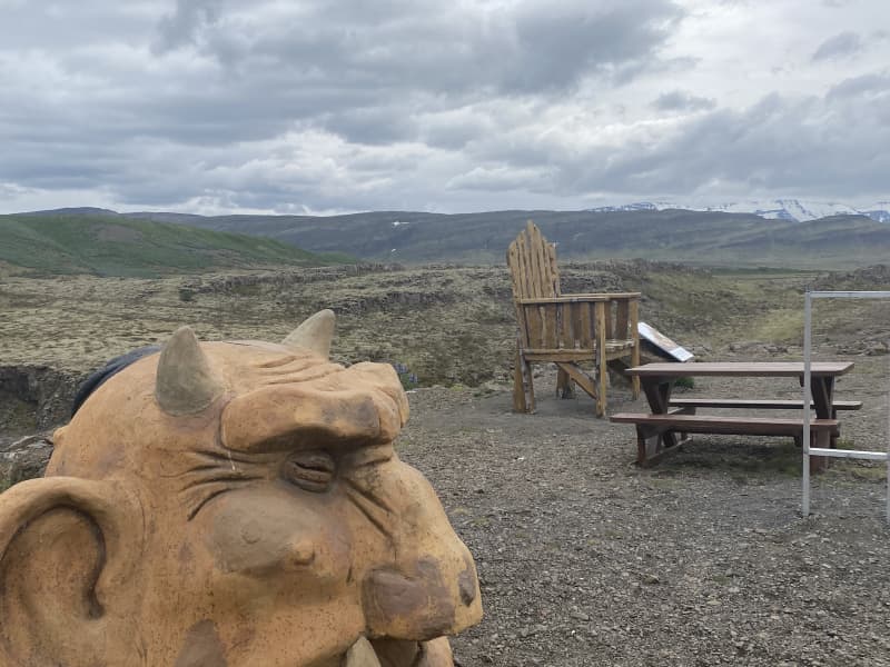
Troll walk in Fossatun in Borgarfjord among trolls is a splendid idea for parents with children. Live the stories that were made there by walking in the environment. 
Húsafell
In Húsafell surrounding nature you can expect to find dense woodlands, waterfalls, glaciers, rugged lava, crystal springs, wildflowers plus remarkable archaeological remains.Here is a good map with ten hike trails.
Stálpastaða woods, Skorradalur in Borgarfjord
Stálpastaðir in Skorradalur, the farm is abandoned but there are many birch–bushes. Haukur Thors gave the land to the Forestry Service in 1951, since when it has been protected and used for the rather successful cultivation of evergreens.
Einkunnir a country park
Einkunnir is a 270 ha country park, protected for recreational use and the preservation of the typical landscape of the area. The areas’ main characteristics are its rocky islands or bluffs that rise from the areas’ vast flat wetlands. Please follow the marked trails whenever possible.  Do not drive off-road, damage geological formations or vegetation.  Do not disturb the wildlife or light fires in vegetated areas. Please take your litter with you when you leave.