Skip to content

Or try searching by Category and/or Location

The locals in West Iceland are proud of their history and eager to introduce visitors to their art of storytelling, poems, and sagas stretching back to the Viking Age. 

Fiskibyrgi Snaefellsnes Peninsula
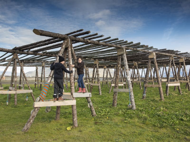
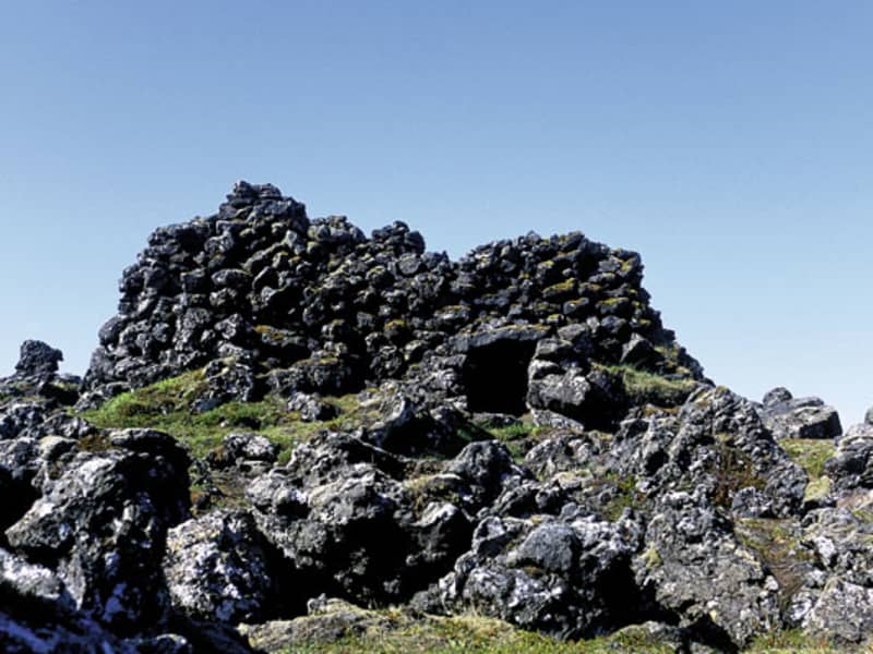
Near Gufuskalar on the uttermost part of the Snaefellsnes peninsula, there was one of the many winter fisher villages consistant in Iceland in former times. If you come from Hellnar and look at the lava fields at your right, you may disover the ruins of some 200 very small stone buildings which were used to dry and stock the fish. Their age is estimated at 500-700 years. It is a 10 minutes walk from the road to one of the ruins which is still in so good condition that you can crawl inside. There, to your surprise, you may find the ceiling high enough for an adult to stand upright.
Skarðsströnd coast
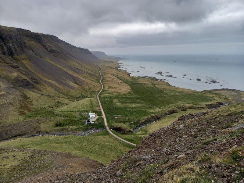
The route via Klofningsvegur no. 590 runs through Hvammssveit, Fellsströnd, Klofningur, Skarðsströnd and Saurbær. Day-to-day it is called going around the coasts.  Until 1918 the boundaries of Skarðsstrandarhreppur were from Ormsstaðir to Fagradalsá, then the district split into Klofningshreppur and Skarðshreppur. The district boundary held until 1986 that Klofningshreppur split over Klofningur between Fellsstrandarhreppur and Skarðshreppur. In Dagverðarnes, Auður Djúpúðga ate a breakfast in her search for her settlement columns. The current church in Dagverðarnes was built in 1934. Outside Dagverðarnes lies Hrappsey where the country's first secular printing house was operated. Klofningur is a natural gap and the road runs through it. At Klofningur there is a sightseeing point and a good view over the islands and out to Snæfellsnes. One of the oldest manor in the country is Skarð á Skarðsströnd. It is the settlement land of Geirmundur heljarskinn and the same family has lived there since the 11th century. Farmers church is in Skarð and there is, among other things, an altarpiece that Ólöf "the rich" Loftsdóttir is said to have given to the church. Below Skarð is Skarðsstöð. There is a lot of bird life and cultural monuments. Skarðsstöð was the first legalized trading center in Dalasýsla in 1884 and now houses a fishing port. The community center Röðull is located below the road by Búðardalsá. In Röðull there are often exhibitions related to the life and culture of the people of Skarðsströnd. In the 18th century, Magnús Ketilsson, an magistrate and a great progressive man, lived in Búðardalur and did significant agricultural experiments and wrote a number of scholarly articles. Ytri-Fagridalur is the innermost town on Skarðsströnd and is the settlement land of Steinólfur "the low". Over there you can see Hafratindur, the mountain of Dalir.
Garðalundur Akranes forestry
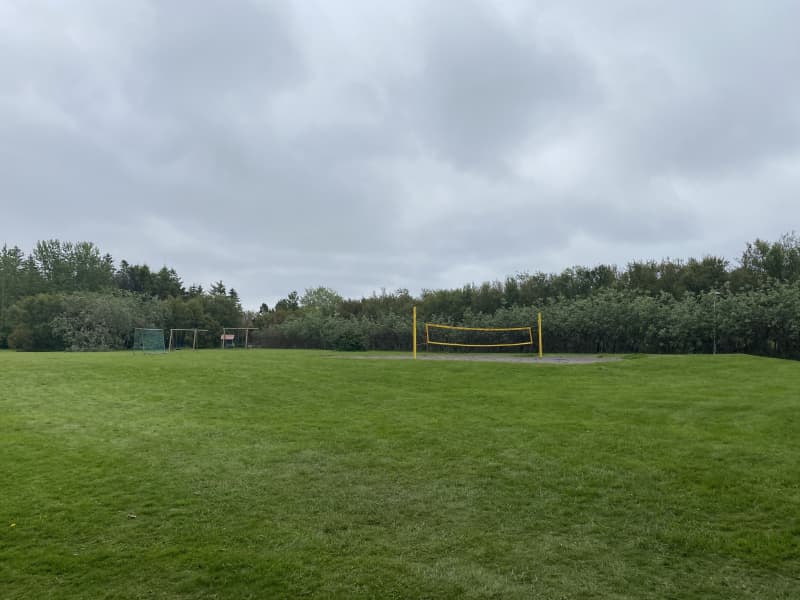
At Akranes, you can find three fun hiking trails through forestries. One is in Garðalund, one in Klapparholt and one inSlaga. Garðalundur has a variety of recreational opportunities for the residents and visitors of Akranes, Klapparholt is a forest where you can find many different types of vegetation, such as birch and pine and at Slagi forest,which is located at the roots of Akrafjall mountain, where visitors can find different walking trails, along with different plant life and fantastic views over Akranes and Faxaflói bay.   In Garðalund you can find a variety of recreation for residents and visitors of Akranes. Volleyball court, frisbeegolf course, exercise equipment, resting places, cabin, walking trails and information boards. A flourishing social area, with infrastructure like toilets and garbage bins, where visitors can enjoy the many recreational options thatcan be found in Garðalundur.  Entering Klapparholt, you can find several information sign about the area and the couple Guðmundur Guðjónsson andRagnhildur Árnadóttir, who started cultivation and organization in the area in 1988. You can also find „Klapparholtið“, but it is in the middle of the forestry. There are stories that an elf church and hidden people live in the „Klapparholtchurch“ that stands there. It is popular for outdoor enthusiasts to use the area for walking, running or cycling.  In Slaga forestry you can find resting places and infrastructure like toilets and garbage bins, but is addition there is agreat view of Akranes and the surrounding area. There is a trail from Slaga to the starting path up Akrafjall, but it is also popular for outdoor enthusiasts to use the area for walking, running or cycling.   Area: Akranes  Road number to the starting point: At Garðalund (Klapparholtsvegur) inside Akranes.  Difficulty level: Easy. Accessibility for wheelchairs and wagons but on some trails, the accessibility is not available.  Length: 12.31 km  Elevation: 50-100 meters.  Markings: There can be found marking in some of the areas but not in-between the areas. The paths are very visible.  Duration: 2.23 hours.  Route type: Small rocks, grass and mixed material.  Obstacles on the way: No obstacles inside Garðalundur and Klapparholt but there are steps and difficult grass paths in Slaga.  Services in the area: At Garðalund and at Slaga.  Illumination: Some illumination between the forestries.  Season: The walking trail is open all year round.  GPS coordinates to the starting point: N64°19.3052 W022°02.2243. At Garðalund.  GPS coordinates to the finishing point: N64°19.9648 W021°58.8807. At Slaga.  
Eiriksstadir
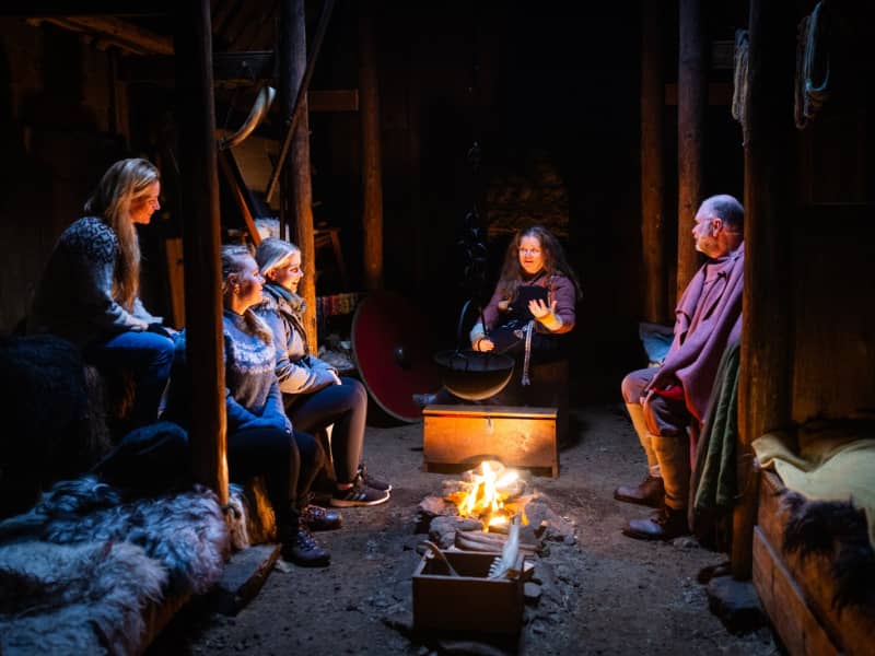
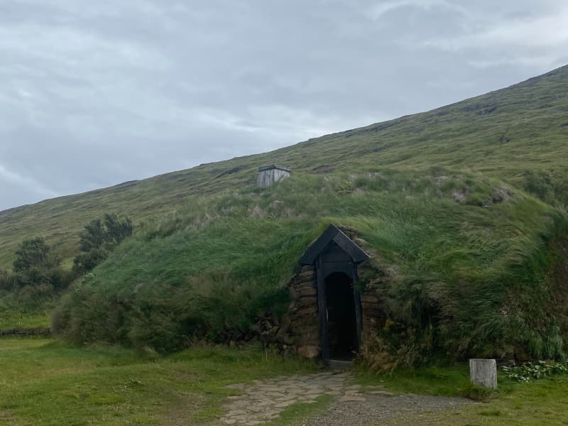
Eiríksstaðir is one of most historic sides of Iceland. Step back to the Viking Era and immerse yourself in the sights, sounds and scents of Eriks the Red's farm which is also the birthplace of Leif the Lucky who is said to have discovered America. Modern day vikings demonstrate the lifestyle of 1000 years ago, sharing their crafts and knowledge.
Brákarey Island Borgarnes
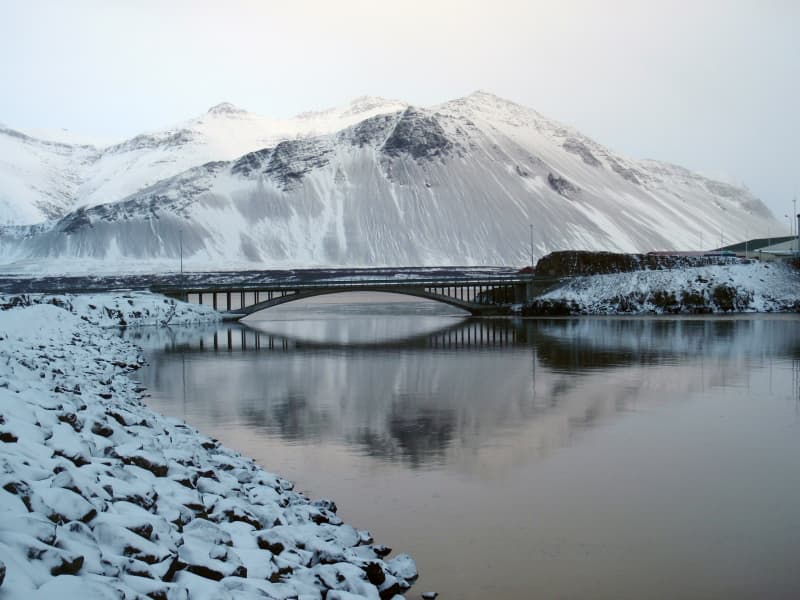
Brakarey is connected to the mainland by a bridge. The island was named after Egill's nanny and Skalla-Grimur´s slave Thorgerdur brak, after Skalla-Grimur killed her and she drowned in the sea near it. From the island is a great view over Borgarfjord.
Hallgrim's Church in Hvalfjord
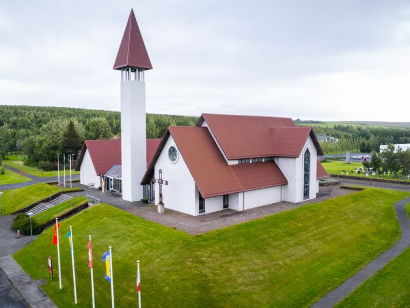
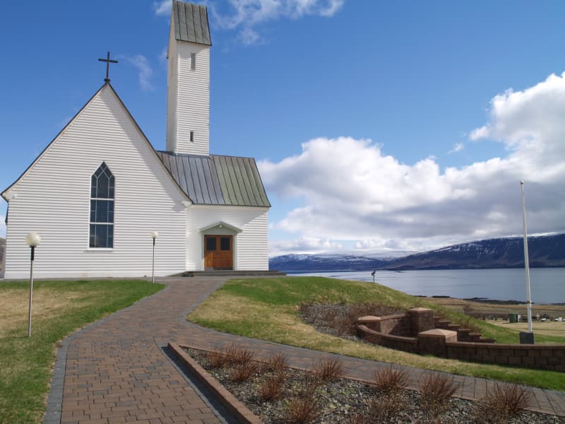
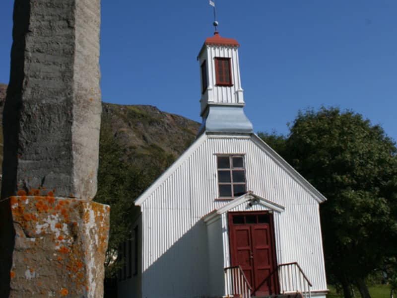
Church built in 1957 as a tribute to the 17th-century hymn writer Hallgrimur Petursson, one of Iceland's best-loved poets. Hallgrimur Petursson served at Saurbaer 1651-1669, a poor leprous pastor who composed Iceland's most widely known religious work, 50 Passion Hymns. Reykjavik's Hallgrimskirkja church is also named after him. Hallgrimur was married to a woman who had been abducted from the Westman Islands by Algerian pirates and bought free again. The church contains beautiful stained glass work by one of the first widely known Icelandic woman artist Gerdur Helgadóttir.
Snorralaug (Snorri's pool)
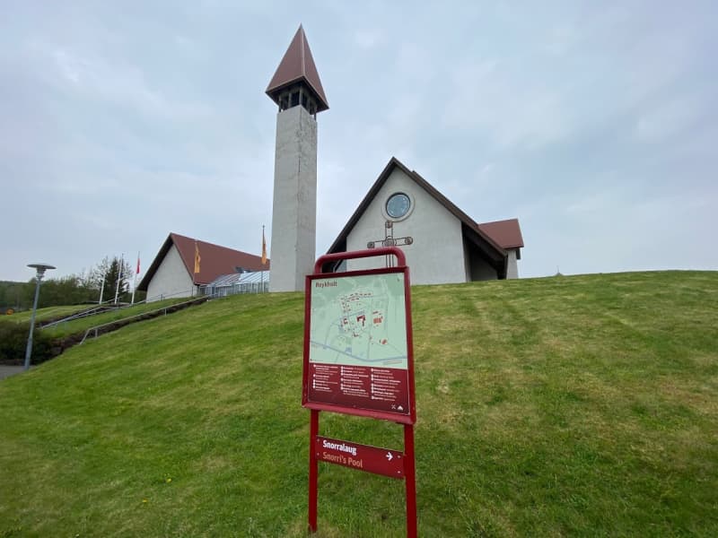
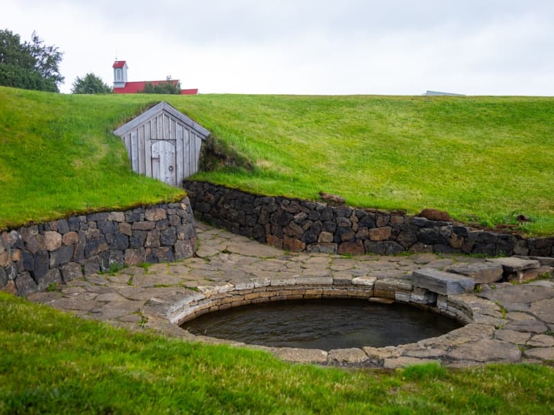
Snorralaug (Snorri's pool) is a historic hot spring, located near Reykholtskirkja in Borgarfjörður. The pool is named after Snorri Sturluson, who was a famous Icelandic poet, historian and politician who lived during the 13th century. Snorralaug is believed to have been used by Snorri for bathing and relaxation and its historical significance lies in its association with Snorri and the medieval Icelandic Sagas. Snorralaug is a popular tourist attraction and a reminder of Iceland's rich cultural heritage. 
Varmaland hiking trail
Varmaland is a small village that has been built around geothermal area in Stafholtstungur in Borgarbyggð. The settlement is located in between Hvítá river and Norðurá river, with a kindergarten, swimming pool and a gymnasium. Laugaland, which is a small farm in the area that uses the geothermal energy for gardening, but cucumbers are grown there all year round. Hotel Varmaland is located in the heart of the village and Varmaland is a popular place to visit and to stay.   Varmaland in Borgarbyggð is a well-known place for tourist, both domestic and international. Varmaland´s campsite has been known among domestic tourists for years, but with the arrival of Hotel Varmaland, more foreign tourists have been introduced to the area. Varmaland is clearly visable from highway no. 1, but the lights and the steam coming fromthe area is very visable. The trail through Varmaland is located in forestry, on the cliffs above Varmaland but from there, you will find great views over the surrounding areas. The trail starts at Hotel Varmaland but turns into theforestry, where you can find a playground for younger generation but also numerous walking and hiking paths. A variety of paths, together with a beautiful landscapes, makes a walk through Varmaland, a very interesting and fascinating experience.   Area: Varmaland, Borgarbyggð.  Road number to the starting point: Hotel Varmaland (no. 527 Varmalandsvegur).  Level of difficulty: Easy.  Length: 5.03km  Elevation: 75 meters.  Markings: Markings can be found.  Duration: 1.07 hours.  Route type: Mixed, small rocks, grass.  Obstacles on the way: Steps on the way.  Services on the way: Hotel Varmaland and gymnasium/swimming pool at Varmaland.  Illumination: No illumination.  Season: The trail is open all year round.  GPS coordinates starting point: N64°21.2886 W021°36.6383  GPS coordinates finishing point: N64°21.2886 W021°36.6383 
Borg á Mýrum-Einkunnir hiking trail
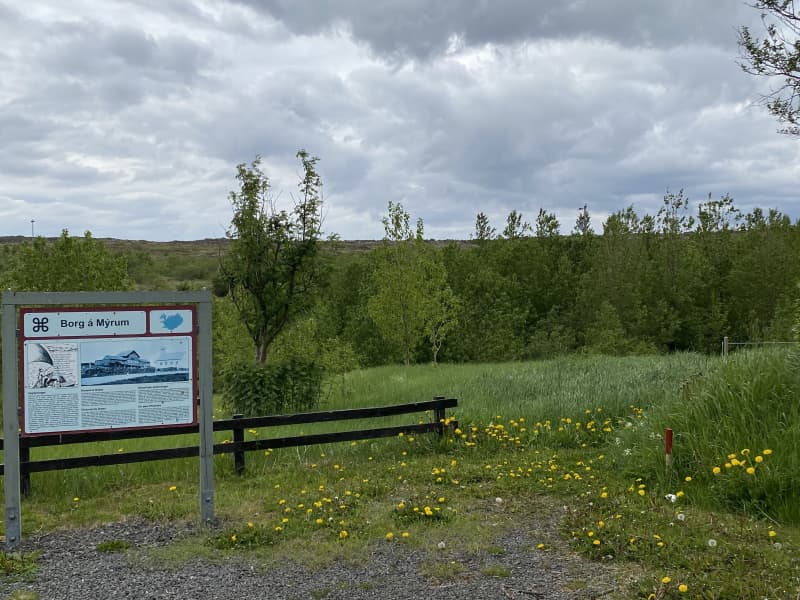
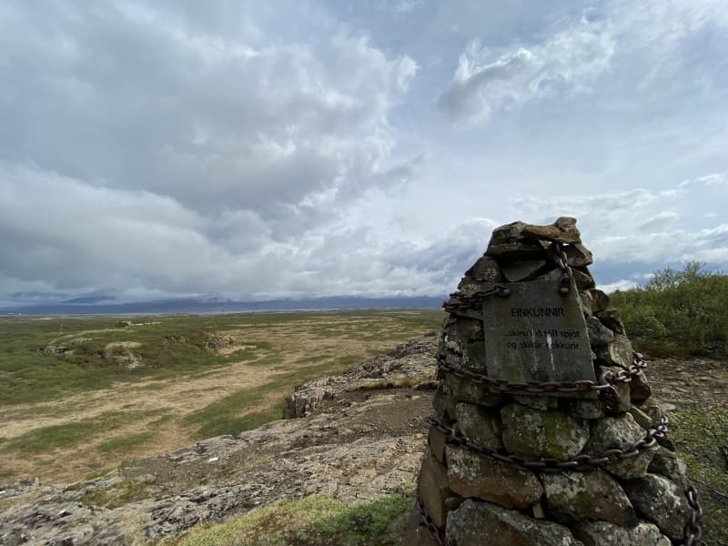
Borg á Mýrum is a church site located west of Borgarnes. The place is, according to Egil Skallagrímsson's story, a settlement ground, but a church has stood there since 1002. Borg á Mýrum is a well-known place as a destination for tourists, whether they are foreign or domestic tourists. The church site has welcomed foreign visitors for years, but visitors have then been guided around the area and have been allowed to see the church under the guidance of the priest at Borg. The artwork Sonatorrek and a view of Borgarnes and Hafnarfjall faces visitors who come to the church.   Einkunnir country park are a 273 hectare country park that can be found north of Borgarnes. Forestry has been theresince 1951, but within the country park there is a beautiful pond, Álatjörn, along with a number of footpaths, resting places and beautiful forestry, which makes Einkunnir one of the pearls of Borgarbyggð. Monuments are on the trail atBorg á Mýrum but also on the hiking trail between Borg and Einkunnir. In 2015, the registration of relics along the trail began, but there you can find relics of a sheep stable, a shepherd's house, a shelter and more. Hikers are asked torespect the relics that are found.  The trail is marked all the way, but keep in mind that in many places it is difficult to cross ditches and swamps along theway. The trail between Borg á Mýrum-Einkunnir offers a magnificent view of Hafnarfjall and Borgarnes along with the beautiful wildlife that can be found along the way.    Area: Borg á Mýrum/Einkunnir country park, Borgarbyggð.   Road number to the starting point: Parking lot by Borg á Mýrum(road no.54).   Level of difficulty: Moderate.  Length: 5.26km.  Elevation: 123 meters.  Markings: Markings on the trail.   Duration: 1.30 hours.   Route type: Small rocks, mixed materials, and grass.   Obstacles on the way: There are steps on the trail.   Service in the area: Toilets are accessible at Einkunnir.   Illumination: No illumination.   Season: The route is open all year round but be aware of winter condition on the route.  GPS coordinates to the starting point: N64°33.6630 W021°54.9579 (At Borg á Mýrum)  GPS coordinates to the finishing point: N64°35.8993 W021°54.6785 (Ends at Einkunnir).   
Skard in Skardsstrond, Dalir
Skard is a farm and church site on Skardstrond. Many of the Icelandic Saga heroes come from here. Amongst them were Bjorn Thorleifsson, governor, and his wife, Olof-the-Rich Loftsdottir. On the death of her husband by Englishmen in 1467, she is quoted as declaring: "shed no tears for farmer Björn, but gather men to avenge him..." This has become a famous quote in Iceland. The Skard church was the main church of the area for a long time. The church was rebuild between 1914-1916 and there are many old relics to be found in it, among them a preacher´s stool from the 17th century.
Helgafell hiking trail
Helgafell is a basaltic rock mountain located just outside Stykkishólmur. At the foot of the mountain there is a parking lot with signs related to the history of the place and the whole approach is exemplary. At the beginning of the hike, you walk through a gate, but then a footpath leads hikers up to a viewing disc and a piled rock formation that can be found at the top of Helgafell.   Helgafell in Helgafellssveit is a famous and ancient ground, but it is featured in some ancient Icelandic stories, some ofwhich are believed to have been written at Helgafell. There is a lot of history attached to the area and a magnificant view from the top of Helgafell, where you can see over the Breiðarfjörður bay and the mountains of Snæfellsnes. Oldfolklore says that those who walk Helgafell for the first time, have the option of making three wishes when they reach the top of the mountain. The criteria are that you walk in silence to the top and do not look back. When you reach the top, you look to the east and make three wishes in your mind and tell no one.   Area: Helgafell, Helgafellssveit.   Road number to the starting point: Helgafellsvegur (from Stykkishólmvegur no.58).   Level of difficulty: Easy path.  Length: 500 meters.  Elevation: 73 meters.   Markings: No markings.   Duration: 10 minutes.   Route type: Small rocks, mixed materials, large rocks and tree curls.  Obstacles on the way: Steps are on the paths.  Services on the way: At the car parking area there are garbage bins and toilets.   Illumination: No illumination.   Season: The trail is open all year round but be aware of winter conditions before hiking.  GPS coordinates starting point: N65°02.5055 W022°43.9716   GPS coordinates finishing point: N65°02.5055 W022°43.9716   
Djúpalónssandur
Djupalonssandur is a beautiful pebbled beach, with a series of rocks of mysterious form emerging from the ocean. It is one of the few areas that lead down to the sea along this coast with its high dramatic cliffs. Watch out for the famous ghosts roaming the place! The rests of a shipwreck can be seen on the beach. On the beach there are also big stones which people tried to lift and test their strength in the days of the fishing stations: Fully Strong 154 kg, Half-Strong 100 kg, Weakling 54 kg and Bungler 23 kg. Weakling marked the frontier of wimphood, any man who couldn't lift it was deemed unsuitable for a life as a fisherman.
Helgafell Holy Mountain
Holy Mountain, 73 m with a breathtaking panoramic view across Breiðafjordur Bay. A viewing dial is at the top.   Folklore advises anyone climbing the mountain for the first time to walk straight up without looking back or speaking and three wishes will be granted. The wishes have to be of good intent and the wisher tells no one and faces east when making them.  A small remnant of a wall on the mountain top is dated 1184 and was a part of a nearby monastery built at this time. 
Staupasteinn in Hvalfjörð
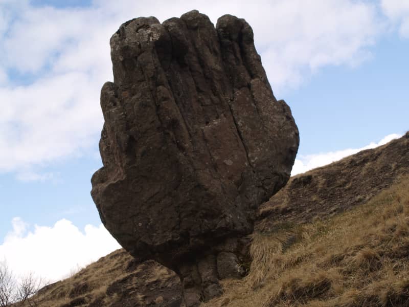
A goblet-shaped rock and popular resting place for tourists. Close to Hvammsvik on the old national road around Whale Fjord. An elf by the name of Staupa-Steinn has his home in this rock. Not everyone can see him. He is described as having long hair, a beard and being a kind, gentle man who loves to play ball with children who are picnicking in the area. Beautiful view. Protected since 1974.
Bárður Snæfellsás walking trail
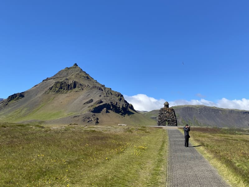
Arnastapi is a well-known tourist destination around Snæfellsnes and there has been some development in the area in recent years. Some walking paths around the area are now easily accessible, and there are a large number of restaurants and accommodation facilities in the area. The harbor at Arnastapa and the hiking trails between Arnastapa and Hellnar are destination/resting places. The environment as a whole in the area is unique, where the bird life, combined with the diverse landscape, makes Arnarstapi one of the most popular destinations in the West. The large loaded image of Bárði Snæfellsás by Ragnar Kjartansson towers over the area and the coastline of Arnarstapa. Area: Bárður Snæfellsás, Arnarstapi. Snæfellsnes. Road number to the starting point: Arnarstapavegur (no. 5710). Level of difficulty: Easy. Lenght: 1.18km. Elevation: 30 meters. Markings: No markings. Duration: 18 minutes. Route type: Mats and small rocks. Obstacles: No obstacles. Services in the area: Toilets and garbage bins are available. Illumination: No illumination. Season: The trail is open all year, but it is advised the the path may be slippery due to ice during the winter. GPS coordinates starting-and ending point: N64°45.9992 W023°37.7660
Hellnar in Snæfellsnes
For centuries, Hellnar was among the largest fishing villages beneath the Snaefellsjokull ice cap. Valasnos, a freestanding rock, extends east of the bay. One of Iceland's most peculiar caves, Badstofa, is there. It is known for its special light exposure and colourful interior. A cold water spring is to be found at the lava's edge. It is dedicated to the Holy Virgin because it is said she appeared there once. The Hellnar church was built in 1945 on a picturesque site where a church was first raised in 1833. Located at Hellnar is a Hotel and a charming little café.
Beruvík hiking trail
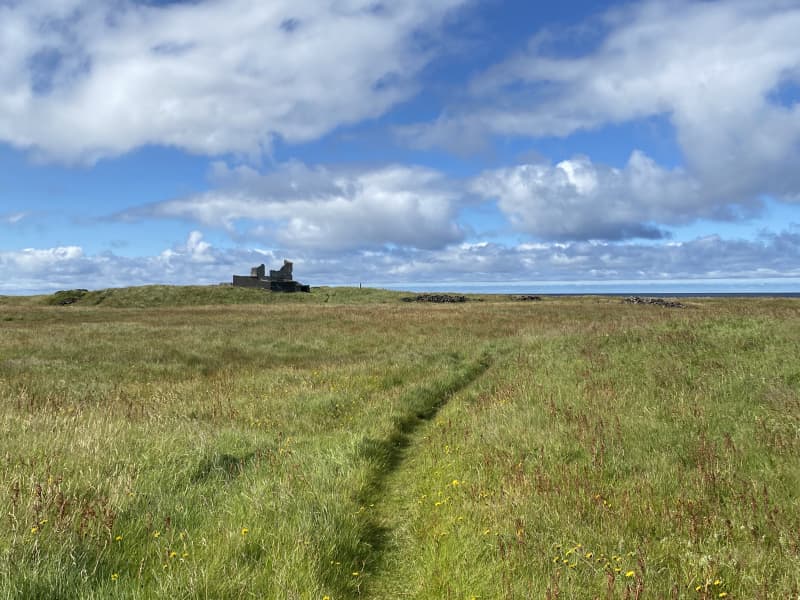
The beginning of the hiking trail is at the parking lot at Beruvík. The trail leads through the ruins of houses that used to be in Beruvík and the path is well marked. It is said that a woman named Bera lived in Beruvík. In Beruvík there were two lands, Garðar and Hella. Nýjabúd, Bakkabúd and Helludalur were sublet. The land was difficult for farming because small fields and lava made it difficult for farmers. However, it was sheltered and good grazing all year round. Farmers fetched the sea from Beruvík and used the driftwood from the ocean. The settlement ceased in the middle of the 20th century. The walk through Beruvík, you pass between town ruins, but you can see, among other things, sheep bath where sheep were bathed due to itch mite in sheep, Nýjabúd ruins and various ruins while Snæfellsjökull towers over visitors. Area: Beruvík, Snæfellsjökull national park. Road number to the starting point: Útnesvegur (no. 574). Level of difficulty: Moderate. Lenght: 1.17km. Elevation: 7 meters. Markings: Markings are visable. Duration: 18 minutes. Route type: Lava field and grass. Obstacles: Trails are narrow, grass paths, and mixed surfaces. Services in the area: No services. Illumination: No illumination. Season: The trail is open all year, except in the months March and April. GPS coordinates starting-and ending point: N64°48.7933 W023°57.6929
Ingjaldshóll Church
This former parsonage and estate between the villages Hellissandur and Rif was the common assembly site of the parish in the past. The present church was built in 1903 and is the oldest concrete church of the country, perhaps even the world. When it was built, it received a replica of the altarpiece of the Lutheran Cathedral of Reykjavik.
Malarrifsviti, Light house in Snæfellsnes
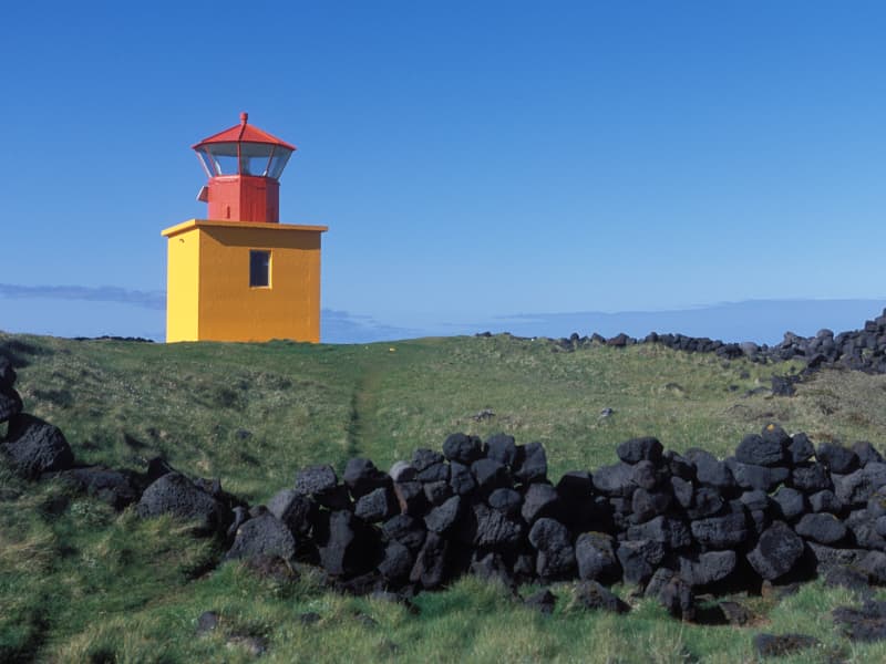
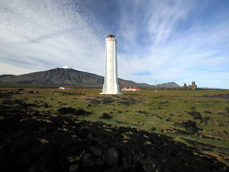
Outermost on Malarrif on Snaefellsnes is a lighthouse that was build the year 1917, close to Londrangar.  A newer lighthouse was build 1946 and is 20,2 meters also an house for the lighthouse keeper as build, a bit later.  The lighthouse was protected the year 2003, along with six others along the coastline, when 125 years had passed since the first lighthouse was build in Iceland. 
Borg
Originally the home of Skalla-Grimur, father of Egill, hero of Egil´s Saga. Its full name means "rock in the marshes". The farmstead was defined by Kveld-Ulfur, Egill Skalla-Grimsson's grandfather, who got on the wrong side of King Harald Fairhair of Norway and fled to Iceland. As they approached Iceland on their way from Norway, Kveld-Ulfur became ill and knew he would die. He instructed his son to make a coffin for him, place his body in it and throw it overboard. The son was to select the site for the family farm where the coffin washed ashore. This happened to be at Borg, where Egill's father settled and raised his family. Today you can see a small church, the large rock that gave the place its name and an interesting sculpture at Borg by Asmundur Sveinsson commemorating Egil´s poem, Loss of a Son. A thoughtful reflection on the emptiness he felt after his son's death.
Búðir-Búðaklettur-Frambúðir
Búðir is located in the westernmost part of Staðarsveit in Snæfellsnes. At Búðir, there once was the most active tradingcenter at Snæfellsnes and a thriving fishing village, but archaeological remains have been found, for example at Frambúðir, indicating activities since the first settlement of Iceland. The vast lava field of Búðahraun stretches east towards the sea at Faxaflói and west to Hraunlandsrif.   The hike trough Búðir-Frambúðir and Búðaklett is a diverse nature experience. The nature of the area, combined with the history and monuments that exist, makes the hiking trail a unique experience. Trails are well marked, with bars and signposts along the trail but the trail from Frambúðir to Búðakirkja has few signpost but it is only a short trail betweenthe two. Búðahraun in on the natural heritage list of the Icelandic Environmental Protection Agency, but the area is one of the most popular destination in west-Iceland. Hótel Búðir is a popular choice when it comes to accommodation and catering, the church at Búðir is extremely popular for weddings and is the best known church in west-Iceland. The area around Búðir is a popular outdoor area, with golden coastline mixed with black coastlines and spectacular nature, topped off with the Snæfellsjökull glacier towering over the whole area. Area: Snæfellsbær  Road number to the starting point: Turn off the highway nr. 54 (Snæfellsnesvegur), on to road nr. 574 (Útnesvegur)and there take the road to Búðir (Búðarvegur).  Difficulty level: Easy. Simple walking paths that a number of groups can enjoy.  Length: 6.8km  Elevation: 88 meters.  Markings: Markings are available.  Duration: 1.4 hours.  Route type: Small rocks, grass, lava field and mixed material.  Obstacles on the way: Steps are on the path.  Services in the area: Service is at hótel Búðir.  Illumination: No illumination.  Season: The route is open 12 months of the year.  GPS coordinates to the starting point: N64°49.3046 W022°23.0755   GPS coordinates to the finishing point: N64°49.3046 W022°23.0755   
Flatey Island Breiðafirðir
Beautifully kept old houses in cheerful colours line the dusty path through the settlement of Flatey island. Walk through it, and at the end of the settlement, the path becomes even narrower and more crooked, taking you through a dense population of birds, consisting mainly of Arctic terns. Two families stay on the island throughout the winter, but many more migrate during the summer, mainly for leisure but also to serve tourists. In a charming way, it feels very much like a movie set. And so it is. Many movies are set on the island, most notably The Honour of the House based on a short story by Nobel Prize winner Halldór Laxness, and White Night Wedding, a movie by Baltasar Kormákur. In fact, Baltasar’s father painted the unusual altar piece in the island’s church, making it worthy of a visit. In summertime, a ferry goes to Flatey twice a day from Stykkishólmur and Brjánslækur, and, albeit less frequently, a passenger boat offers connection to Reykhólar.
Hvanneyri walking trail
Hvanneyri is a small, growing urban area in Borgarfjörður, where the headquarters of the Agricultural University of Iceland (LBHÍ) is located, but also where the Agricultural Museum of Iceland is located, the store Ullarsel and Hvanneyratorfan, which are the old schoolhouses in Hvanneyri. The trail goes out to Andakílsá, a protected area of the Environment Agency, a Ramsar site, that is a bird sanctuary around Hvanneyri. Hvanneyrartorfan is a protected area of the Heritage Foundation, but in addition, the Agricultural University of Iceland has taken care of the maintenance of footpaths in the area as well as volunteers. There has been a lot of development in hiking trails and outdoor recreation areas in Hvanneyri and has a wide attraction for outdoor enthusiasts.   Hvanneyri has history, nature and outdoor activities to offer. The bird life in the area is varied, but the attraction ofwildlife has drawn many tourists to see the whitefronted goose, whose protected area is in Hvanneyri. Torfan attracts visitors to Hvanneyri, but the old school buildings are still in use and have different functions, such as a cafe, sportshall, museum building and apartments for the teachers of the University of Agriculture.   Hvanneyrartorfan is on the Icelandic Heritage Foundation's list of protected buildings and structures, but they areHvanneyrarkirkja (built in 1905), School House (built in 1910), School Principal's House (built in 1920), Skemman (built in 1896), Gymnasium (built in 1911), Hjartarfjós ( built between 1900-1901), Halldórsfjós and barn (builtbetween 1928-1929) and Vélahús. The Environment Agency protected Hvanneyri as a habitat for birdlife in 2002, but then expanded the area in 2011 and was then named Andakíll. The goal of conservation was and is to protect the wetlands found there, which are the habitat of numerous bird species.  The trail starts at the parking lot of the Icelandic Museum of Agriculture and goes towards LBHÍ, heading out to Andakílsá. The trail joins the main road in a small section, but otherwise you walk on dirt roads, mats, paved paths, tree trunks and some rocks.  From April 20 to July 20 is the nesting season for birds, so visitors to the area are advised to pay special attention to birdlife in the protected area. Dogs/cats are not allowed to roam freely in the area.   Area: Hvanneyri, Borgarbyggð.   Road number to the starting point: Agricultural Museum of Iceland (Hvanneyrabraut no.53).  Level of difficulty: Easy path.  Length: 8.77km  Elevation: 12 meters.   Markings: Path is marked but not everywhere.   Duration: 1.46 hour.   Route type: Small rocks, mixed materials and tree curls.  Obstacles on the way: Steps are on the paths.  Services on the way: At the Agricultural Museum, at the Ullarsell store and at the LBHÍ.  Illumination: No illumination.   Season: The trail is open all year round but it is important to stay on the trail from 20th of April to 20th of July each year because of the nesting season in the area. GPS coordinates starting point: N64°33.8794 W 021°45.9281  GPS coordinates finishing point: N64°33.8794 W 021°45.9281 
Hvammur in Dalir
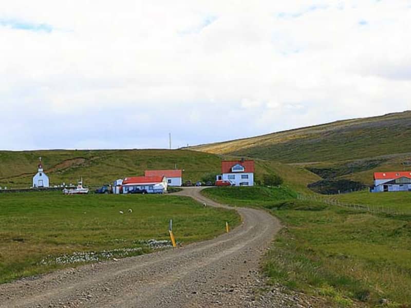
Around the year 890, Audur the Deep minded (djúpúdga) from Dogurdara settled the land between the outer edge og Hvammsveit and Skaumuhlaupsa in Hordudalur. She built her farm at Hvammur and for a long time after her kin lived there. Audur was Christian. The father of Snorri Sturluson, Sturla Thordarson (1115-1183), lived at Hvammur. He was of the ninth generation counting from Audur the Deep minded. His sons Thordur, Sighvatur and Snorri were born there. Arni Magnusson (1663-1730), professor and collector of medieval manuscripts, grew up at Hvammur. Priests would remain at Hvammur. Since the Reformation until 1944 only 15 priests held the position.
Ondverdarnes, Lighthouse, in Snaefellsnes.
Ondverdarnes in Snaefellsnes, a lighthouse. The first lighthouse was build there 1909. A new lighthouse was then made out of concrete the year 1973, taller than the old. 
Dagverdarnes
Takes its name "Breakfast Ness" from the fact that Auður the Deep-minded, one of the first settlers, stopped to rest there one morning while searching for a place to make her home. There is a little church at Dagverdarnes dates from 1934.
Krosshólaborg in Dalir
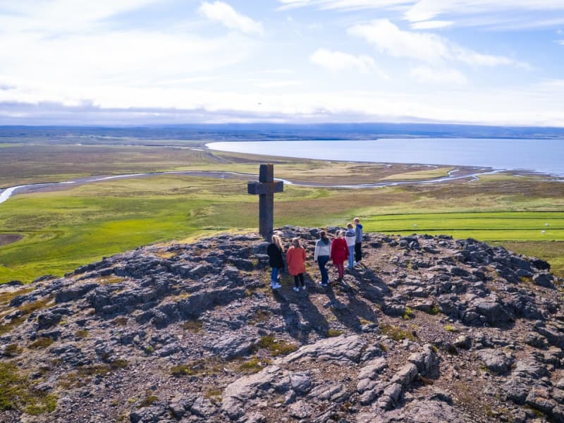
Auður djúpúðga ( Auður the Deep minded) was one of the settlers in Dalir. She was a Christian and had a cross raised at Krosshólaborg, where she went to pray. Her descentants considered Krosshólaborg a holy place. Women in Dalir set up a memorial of Auður, a stone cross in 1965. The remains of Auður´s first farm, Auðartóftir, are nearby.
Vedurhorfur - 112 Words for Wind
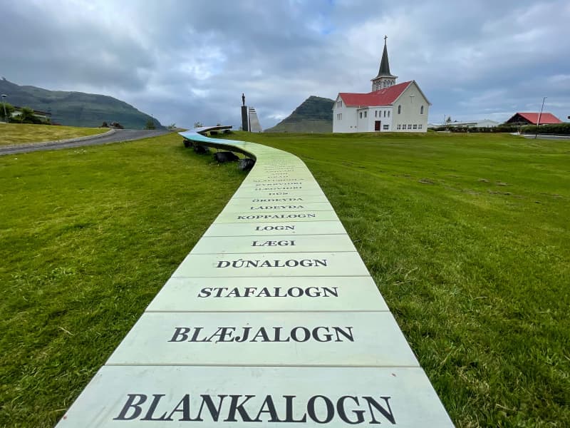
In Iceland you can find over 130 words for wind. The artist, Sólrún Halldórsdóttir, has chosen 112 words out of those 130 to include in this environmental sculpture. By choosing 112 words she is referring to the ermergency number in Iceland, 112.  Livelihood and survival of many Icelanders, especially of commercial fishermen, to this day depends on the weather, and hardly a day goes by without the weather forecast being addressed and discussed. The words are placed in escalating order, from the calmest to the strongest wind we have ever heard of. The artist uses the same color code as the Bureau of Meteorology, but shades have been added to represent each word. To decide the order of the words she interviewed elderly people around Iceland and asked about their feeling and understanding of each word.  Sólrún Halldórsdóttir (1964) was born and raised in Grundarfjörður, the second youngest of eight siblings. Her parents are Halldór Finnsson (1924) and Pálína Gísladóttir (1929). Her mother owned a bookstore in Grundarfjörður and taught Sólrún, at an early age, the love for the language.  The sculpture is 18 meters long and 60 centimeters wide, made of stone, steel and hardwood. 
Barnaborgir hiking trail
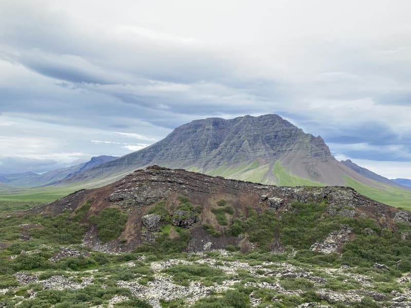
Barnaborg lavafield is a wavy Aa lava field from modern times, where heather and scrub have grown, flowed from Barnaborg. Volcanic cone was in the middle of the lava, but Barnaborgir are two lava hills standing in the middle of the lava field. A fun outdoor area with hiking trail around the lava where you can enjoy the area, the silence and the beauty of Snæfellsnes and Borgarbyggðar at the same time. The Environment agency of Iceland (ust.is) has Barnaborgir on the natural heritage register list. The path through the Barnaborg lava field is visable, but from the parking lot there are steps over a fence, but then visitorsare faced with a clear path that leads visitors into the lava field. When entering the lava field, narrow paths are visable that can be dangerous, but visitors must ensure good footwear before entering the lava field. The area around the lava hills is majestic, where visitors can walk around the area and enjoy the environment, nature and tranquility that the area has to offer.   Area: Borgarbyggð.   Road number to the starting point: Road no.54 (Snæfellsnesvegur).   Level of difficulty: Easy path.  Length: 2.8km   Elevation: 107 meters.   Markings: Markings can be found.   Duration: 45 minutes.   Route type: Small rocks, grass, lava field.  Obstacles on the way: Steps are on the paths.  Services on the way: No services.   Illumination: No illumination.   Season: The trail is open all year round but be aware of winter conditions before hiking.  GPS coordinates starting point: N64°45.3335 W022°14.9905  GPS coordinates finishing point: N64°45.3335 W022°14.9905 
Laugar in Sælingsdal in Dalir
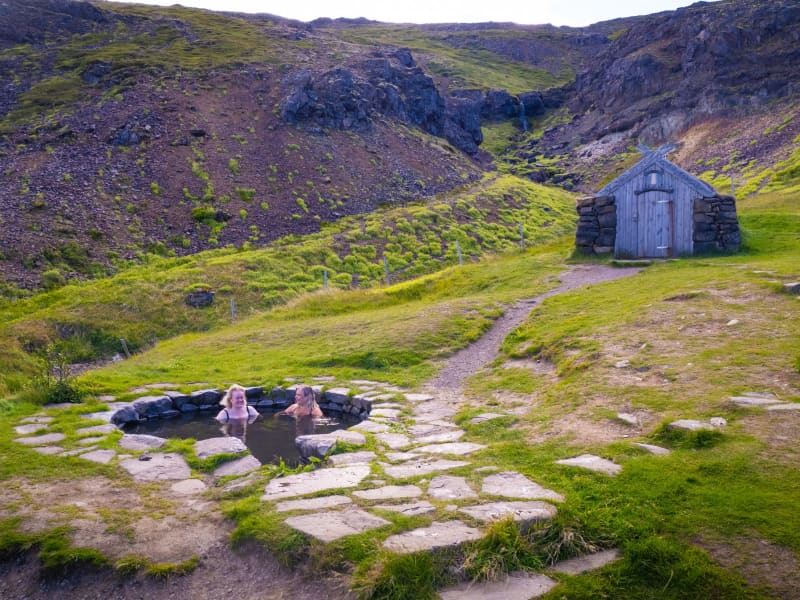
Gudrun Osvifursdottir, heroine of Laxdaela Saga, was born (973AD) and brought up at Laugar. It is said that she used the hot water pool there a lot and also met there her followers Kjartan and Bolli. There is a geothermal area at Laugar and a naturally-heated swimming pool was built there in 1932. The hot water is also used for heating up the buildings at the place. Now there is a 25 meter outdoor swimming pool, with hot tubs, sauna and more.  At about 3 km from Laugar you may find the rocky hill Tungustapi, home of elves.
Akranesviti, Light house in Akranes
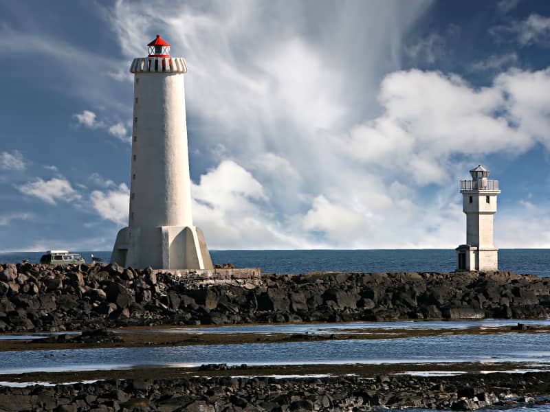
If you are into photography or just interested in exploring new things in Iceland you need to look at Akranes lighthouses. Down by the harbour you will notice two lighthouses. The bigger one that is currently in use is open to the public so you can go up and enjoy the view from there and there is even a photography exhibition to enjoy in there.
Búðakirkja Church
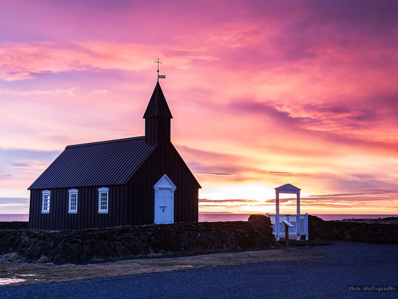
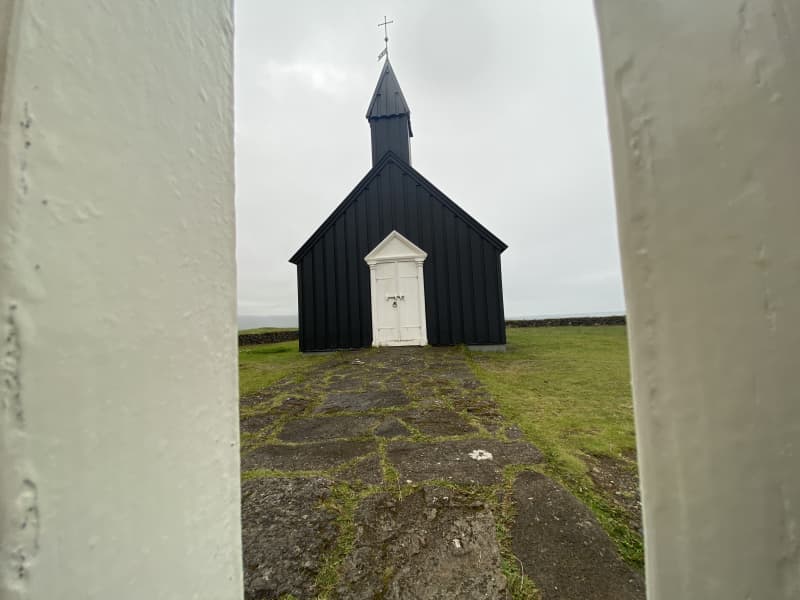
The little black church, Budakirkja Church is located at Budir on Snaefellsnes Peninsula. People come from around the world to seal their love at the church. 
Tröð forestry
The walking trail through Tröð forestry is funand varied. The forestry is a beautiful and good place to enjoy the environmentand enjoy being together. The forestry trail is a fun outdoor trail where youcan assess a campsite, the Maritime Museum and the new building of Snæfellsjökullregional park.   In 1950, Kristjón Jónsson started farming inTröð by Hellisandur. A beautiful area that stood in the lavafield and becamepopular early on among forest-and arboriculture enthusiast. In 2002, the Forestryand Land porection association under the Snæfellsjökull signed an agreementwith Snæfellsbær to take over the management of the area, based on a specialcooperation agreement. The area is well sheltered, an ideal place to enjoy thesurroundings and use the hiking trail that connect the forestry to thecampsite, the sports area, the Maritime museum and Snæfellsjökull regionalpark. Tröð forestry is an „Open forest“, as it was officially open in 2006.Accessibility and facilities are exemplary but into the forest you can findmany hiking trails, resting places, informations and facilities for cooking.The forest is surrounded by a rock-filled fence, but beyond the fence there aremore hiking trails in the surrounding area. Snæfellsjökull shines brightly fromthe forestry and the hiking trail around the lava field is a fun experience.   Area: Snæfellsbær.  Road number to the starting point: Útnesvegur (nr. 574).  Difficulty level: Easy/light.  Length: 2.08km.  Elevation: 0-50 meters.  Markings: No markings.  Duration: 27 minutes.  Route type: Paved paths, small rocks, grass, lavafield and wood sticks.  Obstacles on the way: Steps over the rock-filled fence and steps when walking to the Maritime museum.  Service in the area: Maritime museum and the Snæfellsjökull regional park.  Illumination: No illumination.  Season: The hiking trail is open all year round.  GPS coordinates to the starting point: N 64°31.2295 W021°26.3108   GPS coordinates to the ending point: N 64°31.2295 W021°26.3108   
Eiriksstadir walking route
At Eiríksstaðir in Dalir there are ancient ruins which are probably the farm of Eirík the Red Þorvaldsson and his wife Þjóðhildur Jörundardóttir. The ruins of the farm are protected ancient monuments.  A little west of the ruins at Eiríksstaðir, a replica farmhouse was built, which was inaugurated in 2000 on the occasion of the 1000th anniversary of Leif's successful landing in America.  At Eiríksstaðir there is a living museum. The staff is dressed according to the traditions of the 10th century and educate visitors about life a thousand years ago, old work culture and farming practices. You can also view crafts, weapons and various items from the period. There are also historical information signs in the area and a statue of Leif Eiríksson by Nína Sæmundsson.  Road no. 60 (Vestfjarðarvegur). Turn right onto road no. 586 (Haukadalsvegur) and drive to the parking lot at Eiríksstaðir. There is a good parking lot and a service cabin, along with toilets and information boards. Trails lead to the replica turf house but also to monuments in the area. The trail is partly with small gravel and partly with pavement rocks.  Area: Dalabyggð Road number to the starting point: Road number. 586 (Haukadalsvegur) Level of difficulty: Easy/moderate Length: 0.6 km. Elevation: 29 m. Markings: No markings but the route is visible, except in the case of heavy snow Duration: 13 minutes Route type: Small-paved and flat rocks Obstacles on the way: No obstacles Service: Toilets, garbage bins and the possibility to buy a guided tour in the replica house during opening hours Illumination: No illumination Season: Hiking trail is open all year round, but can be unpassable during heavy snow GPS coordinates to starting- and finishing point: N 65°03.5023 W 021°32.1731
Stálpastaðir forestry
In Stálpastaða forestry you will find numerous tree species and hiking trails throughout the forestry. But the most popular resting place is at the concrete cowshed that can be found at Stálpastöðum. There you can enjoy the view over Lake Skorradalvatn and write in a guest book inside the barn. Locals have been putting on various exhibitions at the barn, such as photo exhibitions, art exhibitions and more. An outdoor area around Stálpstaðir is in the middle of the residential/summer house area in Skorradalur. The area is greatly used by the many visitors and residents of Skorradalur. At Lake Skorradalsvatn there are numerous opportunities for outdoor activities and there is a large target group that can benefit from it. The forestry association has been working hard over the years in trimming and making the paths easily accessible, which makes this trail a unique experience for outdoor enthusiasts. A hiking trail through Stálpastaða forestry is a fun hiking trail that can be used by a wide group of visitors. Accessibility is very good, as walking paths are wide and markings are well visible. The area around the barn is beautiful as the forest service and the residents of Skorradalur have done very well to maintain and present such a diamond. Area: Skorradalur.  Road number to the starting point: Into road nr. 508 (Skorradalsvegur).  Difficulty level: Easy way (the route is a combination of forest road, mountain route and old town. It should be noted that trucks sometimes pass through the forest road on weekdays).  Length: 1.6 km/ 0.99 miles.  Elevation: 0-50 meters / 0- 164ft elevation.  Markings: Some markings.  Duration: 23 minutes.  Route type: Small rocks and grass.  Obstacles on the way: No obstacles.  Services in the area: There is a brochure about hiking trails throughout the forest.  Illumination: Illumination.  Season: The hiking trail is open all year round.   GPS coordinates to the starting point: N 64°31.2295 W 021°26.3108  GPS coordinates to the ending point: N 64°31.2295 W 021°26.3108 
Hvalfjörður
Whale Fjord (Hvalfjörður) is 30km long and 84m deep. Whale Fjord was the site of much British and US military activity during World War II. Some ruins from this period can still be seen in the fjord.
Geirshólmi in Hvalfjorður
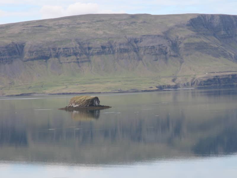
During the Sturlung Age 1220 - 1264, a company of men led by Svarthofdi Dufguson, a follower of Sturla Sighvatsson used the island Geirsholmi as a base for raiding the surrounding countryside. The tourist service at Bjarteyjarsandur nearby offers storytelling trips about Geirsholmi.
Arnarstapi
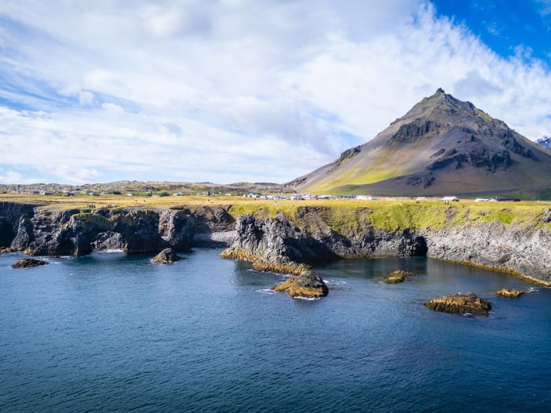
Arnarstapi was an important trading post in the past and had a much bigger population than it has now. Columnar basalt, ravines and grottoes surround the Arnarstapi pier. There is good anchorage for small boats. There is quite a large arctic tern colony in the village itself. A walk along the coastline is recommended to watch the birds and the magnificent lava formations. The seaside and the cliffs between Arnarstapi and Hellnar have been made a Natural Reserve in 1979. A very interesting old path follows the coastline where you can see old lending places of fishermen, lots of birds like the kittiwake, the Arctic tern and the fulmar and pass through a lavafield. If you take a guided tour, you will also hear a ghost story. A sculpture of Bardur Snaefellsas by Ragnar Kjartansson stands by the beach at Arnarstapi.
Breið
Breið is the southernmost part of Akranes and the location of the fishing history of the town. There are two lighthouses open to the public as well as a view point.   For more information contact Akranes Information Office, tel: +354 433 1065, e-mail info@akranes.is.
Barnafoss, Children's Falls
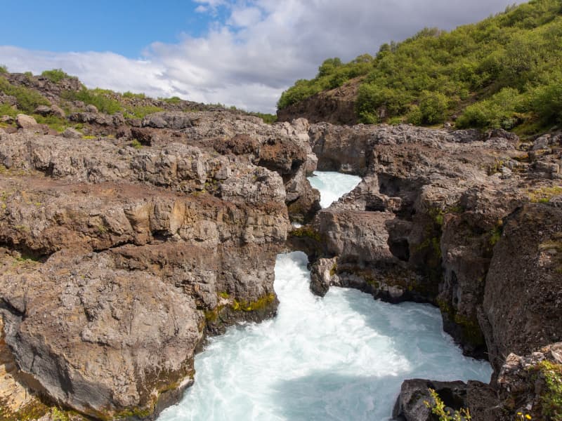
The meaning of this waterfall translates into "Children's waterfall", but the signs here indicated that there was a saga describing why it got this name. The saga said that there were two children in the Hraunsás household who were supposed to stay home while the parents went to church for Christmas Mass. When the parents returned from mass, they discovered that the children had disappeared (possibly because the children got bored and decided to go out).They then followed the children's tracks to this waterfall at the stone natural bridge where the tracks disappeared. The mother concluded that the children must have fallen into the river and drowned. Then, the mother had the arch destroyed in order to ensure no one else faces a similar fate. I've seen some accounts say it was by spell or curse, which induced the bridge's collapse by earthquake. In reality, natural bridges usually collapse over time, and given the powerful erosive forces from the rapidly moving river that undercut whatever was supporting the bridge, that could very well have been the fate of the natural arch here.
Gudrunarlaug, geothermal pool, in Dalir
According to Laxdaela saga, Gudrun Osvifursdóttir used to dwell by a geothermal pool in Laugar in Saelingsdalur. The pool is mentioned in Sturlunga saga and it seems to have been used a great deal. The pool is believed to have been destroyed in a landslide. In 2009 a new pool was built near to the location where the old pool is thought to have been situated and named Gudrunarlaug. A changing facility, referred to as a ”house of modesty“ in Icelandic, was also built at the same time.
Bjossarolo - playground
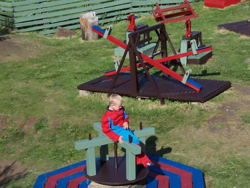
Bjossarolo is a playground for children in Borgarnes, not far from Edduveröld or the Settlement Centre. It was constructed by Bjorn Gudmundsson, a man who was ahead of his time and thought about recycling. He used exclusively things that had been thrown away to build up this special place. At the playground there are for example swings, slides, an old boat, a castle and a lot more in a hollow enclosed by rocks not far from the sea. And on going there you could look for shells or nice stones on the beach. The small, but very pretty park Skallagrimsgardur is not far away. There you can even find the grave of a saga hero!
Svalþúfa og Þúfubjarg
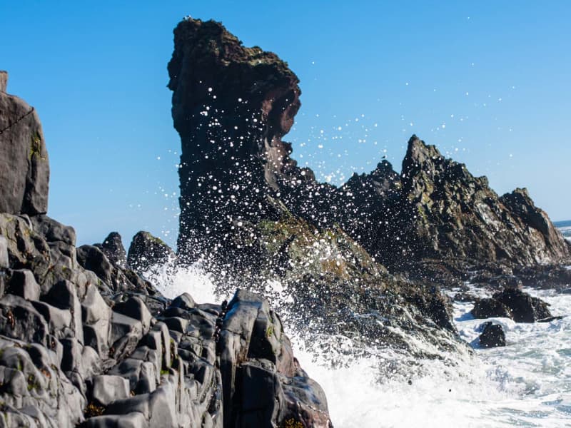
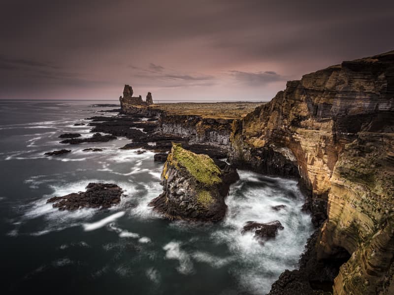
Svalthufa is a high cliff teemed with birdlife and there is a great view to Lóndrangar Cliffs, the front part is named Thufubjarg. Lóndrangar are uniquely-formed remnants of ancient basalt volcanic dikes sticking out from the sea. The higher pillar is 75 m high and the lower one is 61 m. On these cliffs, fulmars have their nests. At Malarrif is the Visitor Center for Snaefellsjokull National Park and it´s fun to walk around the area and explore the nature.  The Devil itself and Kolbeinn the Glacier-poet once sat side by sig at Thufubjarg. They were competing about whom were better poet, as is said in an old folks tale. The Devil lost and Kolbeinn became his master, as is said in the tale. 
Fellsstrond in Dalir
The route via Klofningsvegur no. 590 runs through Hvammssveit, Fellsströnd, Klofningur, Skarðsströnd and Saurbær. Day-to-day it is called going around the coasts. The boundaries of Fellsströnd and Hvammssveit are around Hólsá and reaches Fellsströnd to Ormsstaðir, where Klofningur takes over. It used to be populated on Fellsströnd, but now many premises are not inhabited. Icelandic forest service owns the land Skógar, from where there is almost continuous forest out to Staðarfell. Staðarfell is an ancient manor and church. A housewife school was there 1927-1976, an treatment home from 1980-2018 and there is a community home. Outside Ytrafellsmúli, the lowlands increase and there is some woodland and islands out from the coast. Flekkudalur and Galtardalur go in between the mountains and there lies Efribyggð. From Efribyggðarvegur there is a large and beautiful view of the islands at the entrance of Hvammsfjörður. Kjarlaksstaðir is the settlement land of old Kjarlak. After Flekkudalsá and Galtardalsá merge, it is called Kjarlaksstaðaá. Bjarni Jónsson grew up in Vogur and was called Bjarni from Vogi, after the farm. There is a monument about him by the highway. Until 1918 the boundaries of Skarðsstrandarhreppur were from Ormsstaðir to Fagradalsá, then the district split into Klofningshreppur and Skarðshreppur. The district boundary held until 1986 that Klofningshreppur split over Klofningur between Fellsstrandarhreppur and Skarðshreppur. In Dagverðarnes, Auður Djúpúðga ate a breakfast in her search for her settlement columns. The current church in Dagverðarnes was built in 1934. Outside Dagverðarnes lies Hrappsey where the country's first secular printing house was operated. Klofningur is a natural gap and the road runs through it. At Klofningur there is a sightseeing point and a good view over the islands and out to Snæfellsnes. One of the oldest manor in the country is Skarð á Skarðsströnd. It is the settlement land of Geirmundur heljarskinn and the same family has lived there since the 11th century. Farmers church is in Skarð and there is, among other things, an altarpiece that Ólöf "the rich" Loftsdóttir is said to have given to the church. Below Skarð is Skarðsstöð. There is a lot of bird life and cultural monuments. Skarðsstöð was the first legalized trading center in Dalasýsla in 1884 and now houses a fishing port. The community center Röðull is located below the road by Búðardalsá. In Röðull there are often exhibitions related to the life and culture of the people of Skarðsströnd. In the 18th century, Magnús Ketilsson, an magistrate and a great progressive man, lived in Búðardalur and did significant agricultural experiments and wrote a number of scholarly articles. Ytri-Fagridalur is the innermost town on Skarðsströnd and is the settlement land of Steinólfur "the low". Over there you can see Hafratindur, the mountain of Dalir.
Reykholt in Borgarfjord
Reykholt is one of Iceland's most notable historical sites. It houses a cultural centre and a church. Reykholt is most famous for being the home of Iceland's best-known author Snorri Sturluson during the years 1206-1241. An ancient geothermally-heated pool, Snorralaug, is named after him. It is one of the few things preserved whole from Iceland´s medieval period. Snorrastofa is a cultural centre and institute for research in medieval studies. Snorrastofa offers historical exhibitions and guided tours and lectures. Music recitals are held in the church of Reykholt. Visit Reykholts website www.snorrastofa.is There is one hotel in Reykholt see more here. 
Fossatún hiking trail
Fossatún is a well-known destination in Borgarfjörður, where you can find hiking trails related to folklore heritageand troll books, written by the local keeper, where the stories are set in west Iceland. Fossatún is located in between large summer house areas, where Skorradalur and Húsafell lie on either side of Fossatún. Grímsá river runs nextto Fossatún and you can also find spectacular views of the mountain range of Borgarfjörður at Fossatún.   Fossatún is located about 90 km from Reykjavík, on road no.50, halfway between Borgarnes and Reykholt in Borgarfjörður. Different accommodation facilities are available at Fossatún, from campsites, cottages, guesthouses and country hotel. There is a restaurant as well as facilities for guests to cook, and everyone has access to hot tubs. Fossatún is located on the banks of Grímsá river and has hiking trails along the riverside area, but there is also a hiking trail to Blundsvatn lake, where you can find diverse bird life and a beautiful view of Borgarfjörður´s mountain range.  You can walk from the service area at Fossatún and walk along Grímsá river, where you can find information signs, including sign about the saga´s, legends and trolls. The trail is very visable and accessible for a wide range of guests. The trail to Blundsvatn lake is quite visable but the accessibility is not for as wide range of guests. Grass paths with someparts on gravel is located on the trails but the trail connects the Blundsvatn lake to the Fossatún area.   Area: Fossatún, Borgarbyggð.  Road number to the starting point: Borgarfjarðarbraut (nr. 50).  Level of difficulty: Easy.  Length: 1.75km trail at Fossatún and 3.13km at Blundsvatn lake. Together: 4.8 km  Elevation: 47 meters at Blundsvatn lake and 60 meters at Fossatún. .  Markings: Markings are visable, with information signs and rock formations plentiful.  Duration: At Fossatún is 32 minuets and Blundsvatn lake 40 minuets. Together: 1.2 hours.  Route type: Small rocks and mixed materials.   Obstacles on the way: No obstacles on theroute.   Service in the area: The main service/information house at Fossatún.  Illumination: No illumination.  Season: The route is open except when temporary closed due to bad weather over the winter time or due to bird nestingtime.  GPS coordinates to the staring-andfinishing point: N64°35.5672 W021°34.6263   
Einkunnir hiking trail
In Einkunnir you can find a very diverse landscape, animal-and plant life. The area was protected as a country park in2006, but the goal of the area's protection is to protect the wetlands and geological formations that the public can use for education, outdoor recreation and nature viewing. There are hiking trails throughout the area, and you can find difficult slopes mixed with easy paths in the lowlands. The three rock clusters that rise from the marshland are clearly visible in the distance, but up from Syðri-Einkunnir there is a viewing platform, where you can see the mýrar area,Borgarfjörður and Borgarfjarðadali.   Turn off highway no. 1 and onto road no. 536/3. A road leads to a parking lot at Einkunnir. There you will find information boards about the area's wildlife, along with numerous starting points for hiking trails. The accessibility of carriages and wheelchairs can be found on several routes, but most routes are narrow and there are many inclines. There is a connection to a hiking trail to Borg á Mýrum, but there is also an outdoor recreation area in Einkunnir, where there is a grill, benches and tables. Álatjörn pond together with the number of footpaths, resting places and beautiful forestry makes Einkunnir one of the pearls of Borgarbyggð.   Area: Einkunnir country park, Borgarbyggð.   Road number to the starting point: Parking lot by the forestry (road no.536/3).   Level of difficulty: Easy/Moderate.  Length: 5.2km.  Elevation: 70 meters.  Markings: Markings can be found on the way but needed at times.   Duration: 1.17 hours.   Route type: Small rocks, mixed materials, and grass.   Obstacles on the way: There are steps on the trail.   Service in the area: Toilets are accessible.   Illumination: No illumination.   Season: The route is open all year round but be aware of winter condition on the route.  GPS coordinates to the staring-and finishing point: N64°59824 W021°911   
Akranes walking trails
Akranes is most populous urban area in Vesturland, with about 7.688 inhabitants. Numerous walking trails can be found,with varied terrain and interesting resting places. Walking trails can be found on the outskirts of the town, by the sea and into the town itself, allowing visitors and residents of Akranes to experience great diversity.   Akranes has a lot to offer when it comes to leisure and experience, but the best-known areas are Langisandur beach and Breiðin lighthouse area. Langisandur beach is extremely popular among residents of Akranes, but there are numerous recreational opportunities, whether it´s going to Guðlaug natural pool, sea swimming, exercising or enjoying the coastline and the beauty it holds. Breiðin is a popular destination for tourists, with good infrastructure and good information center. Akranes has done great things regarding accessiblilty and information around the walking trail and is a hugely interesting destination to visit.    Area: Akranes  Road number to the starting point: Kalmansbraut (nr. 51), at the campsite of Akranes.  Level of difficulty: Easy  Length: 10.36 km  Elevation: 0-50 meters  Markings: No markings.  Duration: 2.15 hours  Route type: Paved paths and small rocks.  Obstacles on the way: No obstacles.  Service in the area: At the campsite and different service companies in the area.  Illumination: The majority of the path is lit, but a part that is unlit.  Season: The walking trail is open all year round.  GPS coordinates to the starting point: N64°19.5756 W022°04.0371 at the campsite of Akranes.  GPS coordinates to the ending point: N64°18.7945 W022°02.6144 at the monument „Heaven“.  
Street art town Hellissandur
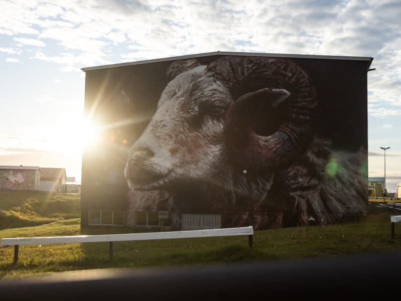
Hellissandur, a small village on the Snæfellsnes Peninsula, has transformed itself into an open-air gallery that surprises visitors with vibrant street art against the rugged Icelandic landscape. Known as the "Street Art Capital of Iceland," the town's murals are painted by a mix of both Icelandic and international artists, who draw inspiration from the rich cultural heritage, natural beauty, and local folklore unique to the region. The murals are spread across the village, but many of them cover the walls of the old fish factory, a central spot where colorful art now contrasts with the industrial setting. Each piece is distinct, often inspired by themes like marine life, Icelandic sagas, volcanic landscapes, and mystical creatures. Artists have brought stories to life, from the playful depictions of puffins and whales to the ethereal images of local folklore figures, turning the village into a living art exhibit. The street art is also part of a larger effort to revitalize Hellissandur, attracting visitors and celebrating the creative spirit of the community. Many of the murals are repainted or refreshed each year, making every visit a unique experience. Walking through Hellissandur, visitors encounter both the vibrant art and the natural beauty of the Snæfellsjökull glacier in the background, making it a truly remarkable fusion of culture and landscape.
Skallagrímsgarður, public park in Borgarnes
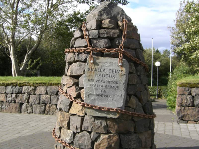
In the heart of Borgarnes is Skallagrímsgarður, a small public park which is ideal for a picnic. The park plays an important role in Egil's Saga, as the burial mound of Skallagrímur Kveldúlfsson, Egil's father, is situated there. It is a good idea to relax in Skallagrímsgarður after a visit to Borgarnes swimming pool which is next to the park.
Ólafsdalu in Dalir
Ólafsdalur by Gilsfjörður, history of 1000 years Ólafsdalur is a small valley, surrounded by high mountains, where the first agricultural school in Iceland was established in 1880. The beautiful school-building is from 1896. Remains of many other buildings and man made remains from 1880-1900. Recently found remains of a Viking longhouse fom 9-10th century!
Reykholt saga circle trail
Hiking around Reykholt saga ring trail is educational and fun. An extensive work has been done on installing signs and build footpaths, making it possible to walk into Reykholtsskógur which is located above the village. It's possible to download an audioguide that adds more fun when walking around the area.  Reykholt in Borgarfjörður is a well-known village for tourists and locals. An ancient and protected pool, Snorralaug, is located in this area. According to Landnáma (the oldest book of the Settlement in Iceland), Snorralaug has been there since 960. In Reykholt is also possible to visit two churches. Reykholtsskógur "forest" is above the churches and there is an ancient highway that passes through and along the forest. Snorrastofa is a research centre where it is possible to get information about the area and where you can find guided tours, lectures and exhibitions. There is also a shop with unique products and gifts. The area has a lot to offer, specially to visitors in search of nature and/or history. Reykholt Festival is held every year at Reykholt.  Area: Reykholt, Borgarbyggð Road number to the starting point: Hálsasveitarvegur (nr. 518), Borgarbyggð Level of difficulty: Easy Length: 1.64km/1 mile Elevation: 50 meters elevation/164 ft.  Markings: No markings on the way Duration: 25 minutes Route type: Small rocks and a paved path Obstacles on the way: No obstacles Services in the area: Toilet is accessible on the route, garbage can be dumped in bins on the way and there is an option to buy guided tour of the route. Snorrastofa provides some services and there is also Fosshótel Reykholt that offers accommodation, restaurant and assistance providing information to visitors.  Illumination: Part of the route is illuminated Season: This hiking trail is open all year round GPS coordinates starting point: N64°66318 W021°292 GPS coordinates finishing point: N64°66318 W021°292 
Höfrungur AK 91
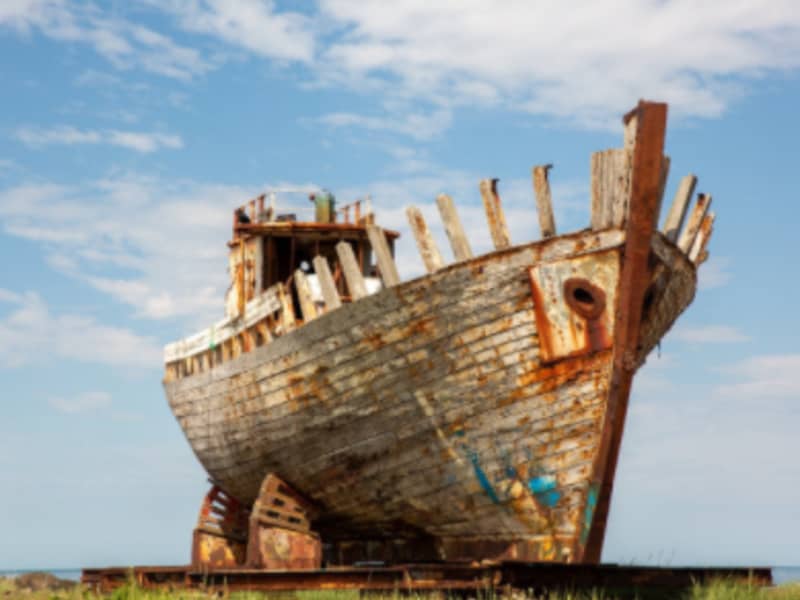
Hofrungur AK 91 (Dolphin) was built in Akranes in 1955 and was for a long time part of Haraldur Bodvarsson’s herring fleet.