Frístundastígur; Ólafsvík-Rif-Hellissandur


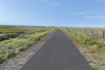
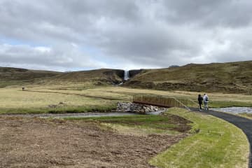
In 2013 the first part of the path was laid between Hellissandur and Rif. A path was subsequently laid between Ólafsvík and Rif in 2014 and it was paved in 2017. A bridge was placed over Höskuldsá in 2020 and is now connected to Ólafsvík-Rif-Hellissandur with a hiking and cycling path. The path is widely used by the local population.
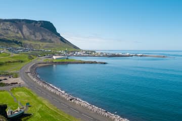
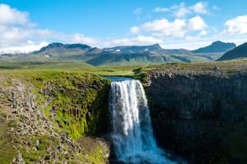
When hiking on Frístundastígur, guests have the opportunity to connect to the pure nature. The path is paved and a diverse group of people can use it. Some parts of the walk are along the coastline, making it possible to admire the beauty of Svöðufoss Waterfall and Snæfellsjökull Glacier. The bird life is abundant in the area and when going down to the Keflavík Cliffs, there is a great spot for bird life observation ad bird life is in its plentitude, and the arctic tern is the most common bird in the area.
- Area: Ólafsvík-Rif-Hellissandur
- Road number to the starting point: Útnesvegur (nr. 574)
- Level of difficulty: Easy
- Length: 19.26 km/11,96 miles
- Elevation: 50 meters/164 feet
- Markings: No markings, however the route is very clear
- Duration: Approximately 1 hour and 20 minutes on bike
- Route type: Asphalt
- Obstacles on the way: No obstacles along the way
- Services in the area: Services available in Ólafsvík, Rif and Hellissandur
- Illumination: Part of the route is illuminated
- Season: This hiking trail is open all year round
- GPS coordinates starting- and finish point: N64°53.3401 W023°41.2849

