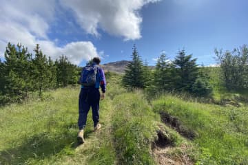
Mt. Drápuhlíðarfjall


Drápuhlíðarfjall is probably among the most beautiful mountains in Iceland. It is 527 meters high, a 3.5 million years old remnant of an extinct volcano. The red and yellow colors characterising the mountain are the hallmark of rhyolite, a silica-rich extrusive (eruption on surface) rock which is the major component of the mountain. The colour is caused by the high contents of silica (SiO2) and consequently the abundance of bright minerals making up the rock. Parts of the mountain are intrusive rocks lower in silica - basaltic and intermediate in composition.
In the past it was a common belief that gold occured in the mountain. Gold has not been found in usable quantities despite considerable search. Fool's gold, however, i.e., iron pyrite (FeS2) glowing as gold, is commonly found in the mountain.
A striking feature of Drápuhlíðarfjall is a large rockslide which fell from the north-western side of the mountain, probably shortly after the end of las ice age. The slide is around one kilometer long and up to 100 meters thick, where it is thickest. Rhyolite tends to cleave easily into thin plates, and such plates from the rockslide were popular as decorative coating on walls and fireplaces around the middle of last century. Numerous homes in Iceland are accordingly decorated by rocks from Mt. Drápuhlíðarfjall. Today, sampling rock here is strictly forbidden.
The farm Drápuhlíð is refered to in the famous Eyrbyggja Saga, written sometime after the year 1250, happening mostly on the north side of the Snæfellsnes peninsula roughly within the timeframe of around 963 to around 1031 AD. In Drápuhlíð lived Vigfús Björnsson, who was a good farmer, but a difficult man to get on with. Vigfús offered his slave, Svartur the strong, to give him his freedom if he would go over to Helgafell and kill Snorri the Priest. This attempt on Snorri's life failed and Vigfús had to pay for his attempt with his own life.
Until the midst of last century, three small farms were located at the base of Mt. Drápuhlíðarfjall, i.e. Efrihlíð, Innri Drápuhlíð and Ytri Drápuhlíð. Numerous ruins of farmhouses and sheepcots are still visible to the southwest of this point.
- Area: Snæfellsnes
- Road number to the starting point: Road number 54 (Snæfellsnesvegur)
- Level of difficulty: Challenging.
- Length: 5.6 km.
- Elevation: 527 meters
- Markings: Markings on the trail
- Duration: 1.5 hours
- Route type: Small rocks, mixed materials and grass
- Obstacles on the way: There are steps on the trail
- Service: No service in the area
- Illumination: No illumination
- Season: Hiking trail is open the whole year round except during winter due to weather conditions
- GPS coordinates to starting- and finishing point: N 64°59.7110 W 022°44.4627

