Rauðsgil hiking trail


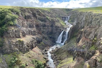
Rauðsgil gorge in Borgarfjörður is on the border between Hálsasveit and Reyholtshrepss. The gorge is deepest at the bottom of the river, as it reaches from 60 to 70 meters deep but becomes shallower as it gets higher up the river. There are large number of waterfalls in the river, including Laxfoss, Einiberjafoss, Tröllafoss and Bæjarfoss waterfalls. The first part of the trail gives hikers a view of high waterfalls, with options to walk along the edge but also on a visable trail further from the edge. As hikers get upriver, the experience of the tranquililty and closeness to the river and waterfalls is breathtaking.
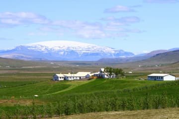
Rauðsgil gorge is a little known place for domestic and foreign tourists that can be a good addition to the nature experience that is available in this area. The experience of visitors who visit and hike Rauðsgil gorge can be great, with the views of the mountain range around Rauðsgil, along with the sounds of the waterfalls. The hike is relatively easy, but there is no climbing along the trail but visitors can choose between the tractor trail further from the gorge or closer to the gorge, but visitor must be aware of the risks if the terrain is slippery or wet. Visitors with dogs are kindly asked to keep them on a leash when the sheep is free in the area, between 1st of June and 30th of September. Larger cars or buses are directed to Rauðsgilsrétt.
Area: Rauðsgil, Borgarbyggð
Road number to the starting point: Gravel pit near Steindórsstaðir farm (road no. 5150).
Level of difficulty: Moderate.
Length: 4.16km.
Elevation: 252 meters.
Markings: No markings.
Duration: 1 hour and 21 minutes.
Route type: Small stones, large stones and grass.
Obstacles on the way: There are steps on the way.
Services in the area: No service in the area.
Illumination: No illumination on the hiking trail.
Season: This hiking trail is open all year round but it is advised that the trail may be slippery due to ice during winter and the area is wet with mud during March until May. The trail is open all year round except when the sheep are herded from the slopes and mountains. 1-2 days a year in September. Informations are by the gate.
GPS coordinates starting- and finish point: N64°39.3434 W021°13.7068

