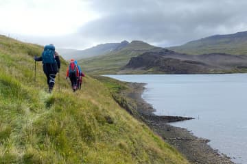
Vatnaleið Hiking Trail


Vatnaleið walking trail, lies past four lakes: Hlíðarvatn lake, Hítarvatn lake, Langavatn lake and Hreðavatn lake. It's a beautiful walking trail that lies through varied landscape, mountains and fields and the view is magnificent over Hnappadalur Valley, Borgarfjörður region and the surrounding area.
The route has been marked and it's possible to stay over night at the mountain cabins on the route.
First Leg - Hlíðarvatn lake - Hítarvatn lake
- Road number to the starting point: Road number 55 (Heydalsvegur)
- Level of difficulty: Challenging
- Length: 12.29 km.
- Elevation: 657 m.
- Markings: Markings on the trail
- Duration: 3.36 hours
- Route type: Small rocks, mixed materials, wetlands and grass
- Obstacles on the way: There are steps on the trail
- Service: Toilets, garbage disposal, campsite and guided tours available
- Illumination: No illumination
- Season: Hiking trail is open exept during winter due to weather conditions
- GPS coordinates to starting point: N 64°54.1901 W 022°08.998 (at Hlíðarvatn lake)
- GPS coordinates to finishing point: N 64°51.9973 W 022°01.0635 (at Hítarvatn lake)
Second Leg - Hítarvatn lake - Langavatn lake
- Road number to the starting point: Road number 538 (Hítardalsvegur)
- Level of difficulty: Challenging
- Length: 21.24 km.
- Elevation: 666 m.
- Markings: Markings on the trail
- Duration: 5.30 hours
- Route type: Small rocks, mixed materials, wetlands and grass
- Obstacles on the way: There are steps on the trail
- Service: Toilets, garbage disposal, campsite and guided tours available
- Illumination: No illumination
- Season: Hiking trail is open except during winter due to weather conditions
- GPS coordinates to starting point: N 64°51.9973 W 022°01.0635 (at Hítarvatn lake)
- GPS coordinates to finishing point: N 64°46.9421 W 021°45.5057 (at Langavatn lake)
Third Leg - Langavatn lake - Hreðavatn lake
- Road number to the starting point: Road number 553 (Langavatnsvegur)
- Level of difficulty: Challenging
- Length: 13.54 km.
- Elevation: 574 m.
- Markings: Markings on the trail
- Duration: 4.06 hours
- Route type: Small rocks, mixed materials, wetlands and grass
- Obstacles on the way: There are steps on the trail
- Service: Toilets, garbage disposal, campsite and guided tours available
- Illumination: No illumination
- Season: Hiking trail is open except during winter due to weather conditions
- GPS coordinates to starting point: N 64°46.9421 W 021°45.5057 (at Langavatn lake)
- GPS coordinates to finishing point: N 64°45.3059 W 021°35.7743 (at Hreðavatn lake)

